Sunday, October 4, 2020

Biking the New River Trail, Virginia

 Date Biked: September 5, 2020 (plus some photos from July 3)

  • Total miles Tracked: 61.56 miles 
  • Type of Trail: Rail trail, gravel surface
  • Conveniences: Parking, picnic tables, bathrooms, two staffed visitor centers
  • Best Features: Mile after mile of rural beauty with plenty of access points and facilities. 
  • Worst Features: Very rough surface in spots, muddy in others. Also, you'll be dodging quite a bit of manure.
  • Wildlife spotted: Racoon, deer, herons, rabbits. Not wildlife, but you'll also see horses and cows.  
  • Vegetation: Mountain laurel, rhododendron, assorted hardwoods, various wildflowers
  • Associated Website:https://www.dcr.virginia.gov/state-parks/new-river-trail
  • Primary Author: James 

Virginia's longest rail trail is the New River Trail State Park. It stretches from Galax, Virginia to Pulaski, with a spur to the small town of Fries. Officially, the trail is 54 miles, but if you want to ride the whole thing in one day, you should count the spur to Fries twice, meaning you'll be biking just shy of 62 miles. 


Biking the whole distance in a single day is a challenge! The trail surface is quite variable. Starting out of Galax, the gravel is so smooth and even it almost feels like you're riding on pavement. But, there are other sections where you're just riding on parallel muddy ruts through fields, and plenty of rough and rocky sections that will put the shock absorption on your mountain bike to the test. We wouldn't recommend a road bike on most of the trail. 


That said, if you can put up with the jostling, the good news is that, if you start in Galax, you'll be riding on a mostly downhill grade for close to 40 miles. It's only after you cross the Hiwassee bridge about ten miles before you reach Pulaski that you encounter a sustained uphill grade. Cheryl and I rode up this mountain several years ago when we were still fairly new to biking and thought we'd never make it to the top, but on this trip we flew along the uphill section without any difficulty.  


All along the ride, you're reminded of the railroad history. Most of the bridges are built on old trestles, and there are two tunnels and several cuts where you ride along cliffs. There are old train stations along the way, with one just outside of Galax and another in Foster Falls that have been converted into visitor centers. 


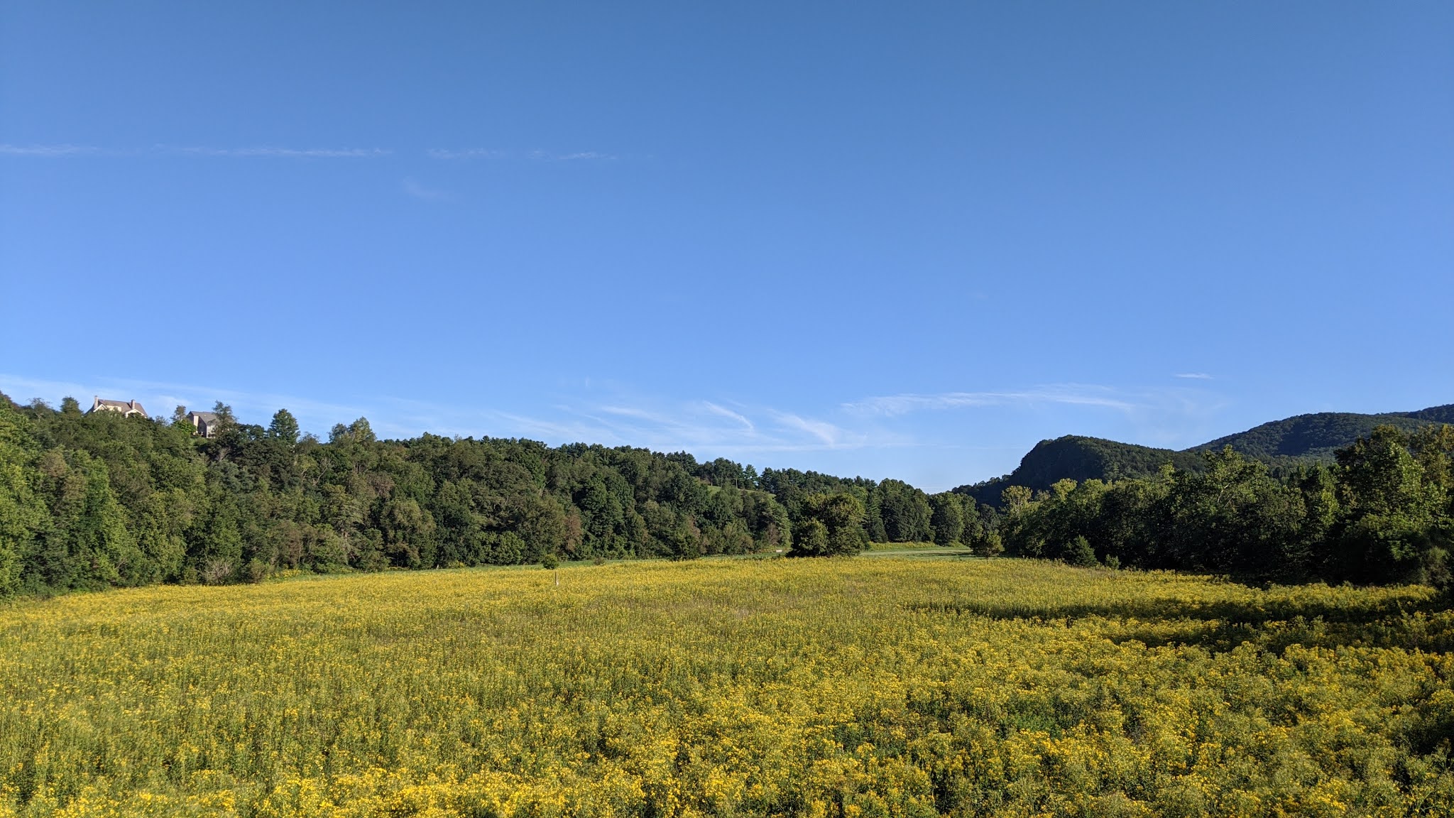
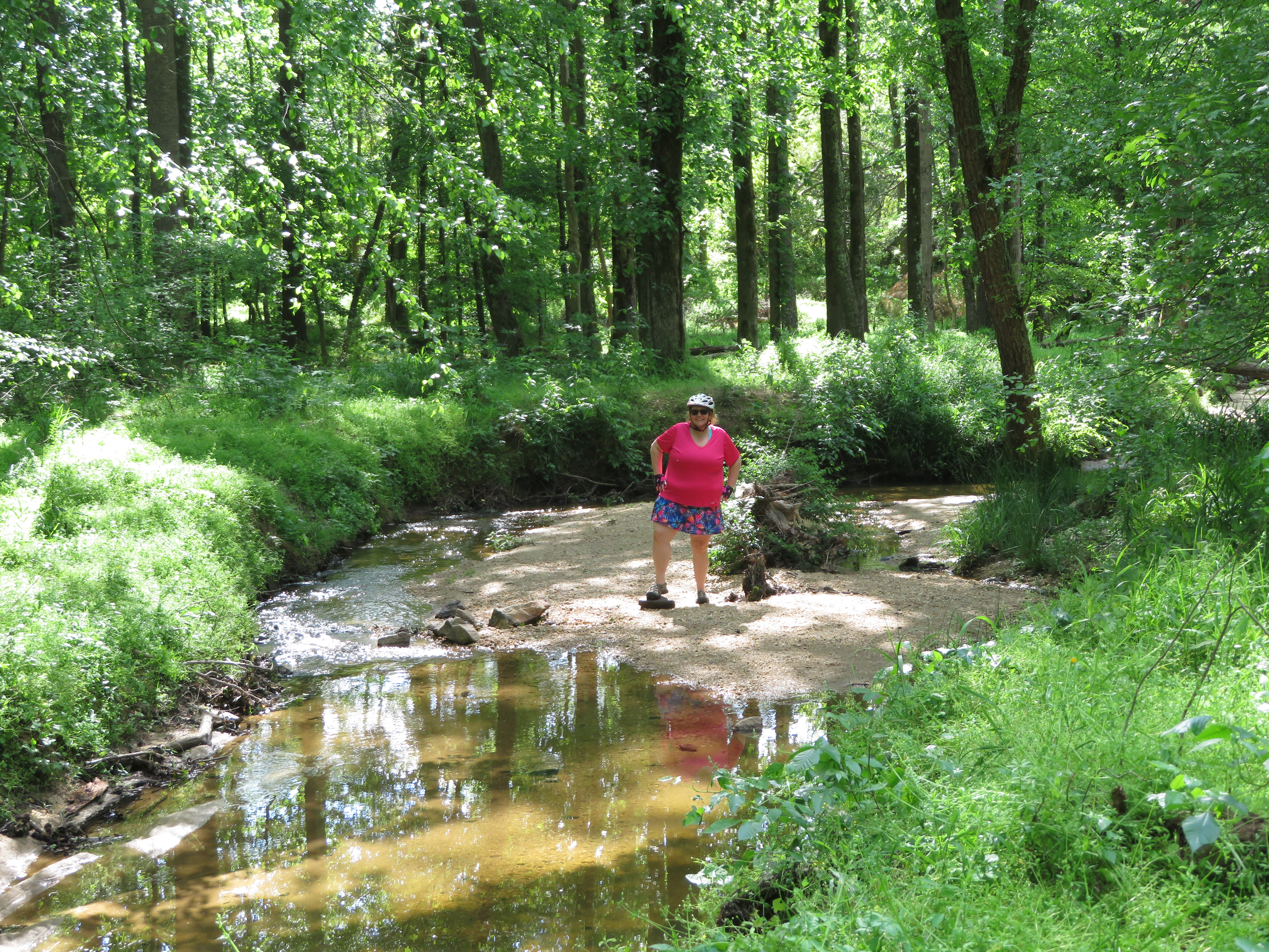
If you'd rather look at nature instead of the remains of a railroad, you're in luck! For most of the ride, you're seldom far from the New River. There are great views all along the way, and plenty of wildlife and wildflowers. Even though you're riding on a mostly flat railroad bed, mountains and cliffs rise up and fall away next to you all along the way. There are some farms, but mostly you pass through forest. Look for herons fishing in the rivers and deer grazing at the edges of open fields. We spotted a baby racoon on our ride, and there are signs all along the trail letting you know to be on the lookout for bears. So keep your eyes open! 


One animal we've encountered every time we've ridden the trail has been horses. The remote, rural flavor of the trail makes horseback riding a popular activity, especially between Foster Falls and the spur to Fries. If you're biking the trail, take extra caution with the horses. Some are ridden by novice riders which can make the horses skittish around bikes. And, of course, if there are horse on the trail, there will be poop on the trail. It makes it a little tough to look at the gorgeous scenery when you have to keep your eyes fixed on the trail to avoid unpleasant splatters. 


We definitely recommend taking the spur to Fries if you have time. First, this will give you great views of the river. Second, at the end of the trail you'll find The CafĂ©. We've eaten here a couple of times and the food and service are top notch. 


Another notable spot along the trail is Shot Tower State Park just before you reach Foster Falls. We skipped it this time since it looked like there was a crowd heading up to it, but if you have time to climb to the top of it you'll be rewarded with an amazing view of the surrounding area. 

Foster Falls is more or less the midpoint between Galax and Pulaski. In the old train station, you'll find bathrooms and a gift shop where you can grab a soda and some ice cream. Don't skimp on the calories, since you'll need for the rest of the ride. If you are riding the full length, by the time you ride past Foster Falls you'll likely be in the shade of the mountain by early afternoon. This part of the trail felt ten degrees cooler than the rest of the ride. 


Eventually you reach the Hiwassee bridge, cross the New River, and start your climb toward Pulaski. The good news is, while it's a sustained grade, the surface really smooths out. There are also multiple amazing views of Claytor Lake (which is the New River, dammed). After you pass over I81, the remainder of the ride into Pulaski is all downhill, but watch out for gullies. Finally, there's a spur trail that takes you to downtown Pulaski, but we've never ridden it. If you recommend it, let us know in the comments! 


One last note: Parking is $8 per car at most of the official trailheads. You can pay by smartphone, but given the spotty reception around some of the trailheads, it's probably easiest just to bring cash. 


Thursday, August 27, 2020

Biking the White Oak Creek Greenway

  • Date Biked: April 26, 2020 and May 9, 2020, plus numerous additional trips all summer
  • Posted length: 14.8 (according to the AllTrails website, which seems like an overestimate... the official Cary Parks website says 4.7, which may be a wee bit out of date)
  • Total miles Tracked: 13.8 miles ATT to Davis Drive (April 26, 2020) and 6.2 miles Davis Drive to Bond Park (May 9, 2020)
  • Type of Trail: Greenway
  • Conveniences: Bond Park, Davis Drive Park, and White Oak Park all have parking, picnic tables, bathrooms, and, in the pre-covid era, water fountains
  • Best Features: Fantastic scenery and well-designed boardwalks on western segment, the full route is part of the East Coast Greenway
  • Worst Features: Older segments are narrow and  have numerous road crossings. The tunnel under 55 floods and is often muddy. Odd lack of maps and mileposts.
  • Wildlife spotted:  Herons, woodpeckers, & turtles. Be on the lookout for beavers! 
  • Vegetation: Pines and hardwoods, wildflowers
  • Associated (very out of date) Website:https://www.townofcary.org/recreation-enjoyment/parks-greenways-environment/greenways/white-oak-creek-greenway
  • Primary Author: James

Aside from the American Tobacco Trail, the trail that our bike tires most frequently touch has to be the White Oak Creek Greenway. Last year, they built a two mile long segment connecting this greenway to the ATT just above the Wimberly Road Trail access. A lot of Cary greenways feel a little slap-dash. It's like they had an extra truckload of asphalt and decided, what the heck, let's just bulldoze a path next to this creek, pour the asphalt, and call it a day. Since the newest segment was going to border a housing development, we worried the trail would be a shoddy afterthought. Instead, the newest segment feels like it was designed by someone who actually loves both bikes and nature. While it does border the new neighborhood, most of the segment is on gently winding boardwalks that snake through the trees. It's built to compliment the wetland forest it travels through, instead of just bulldozing and paving a gash through nature. If we had to judge a greenway simply on its best two miles, this greenway might be the best place to bike in the Triangle. 

What a thoughtfully designed greenway looks like.

This section takes you to an underpass under Green Level Church Road. There's a blind curve here, so watch out for bikers flying down from the other direction. But, as you bike up the boardwalk on the other side, you arrive at the amazing White Oak Greenway Wetlands. This is a quarter mile or so of very wide boardwalk through a swamp full of cattails, skeletal trees, and beaver dams. The wetland changes with the seasons, but depending on the weather you'll find herons here, the occasional egret, red-headed woodpeckers, ducks, geese, and more than a few buzzards. Most of the logs will be full of turtles sunning themselves. Dragonflies flit about everywhere, but curiously we've never encountered mosquitos. There's a beaver lodge easily visible on the south side of the swamp, and another on the north side that's normally hidden by cattails most of the year. And, yes, there are beavers. They are nocturnal, so your odds of seeing one are low, but we have photographic evidence from a previous ride that they do go out of the occasional daytime snack. This is a rewarding area to spend time with binoculars, or a camera with a good zoom lens. 


Just past the swamp, the WOCG intersects the Batchelor Branch Greenway, which looks like a typo, but that's really how it's spelled. This is a short greenway, less than half a mile and it just dead ends on a road where there's no parking lot. But, despite it being a trail to nowhere, we usually ride it because it's flat, uncrowded, and since its adjacent to the swamp we often encounter wildlife, like turtles, snakes, and rabbits. 

Returning to the WOCG and continuing east, there's about two more miles of pleasant greenway before you reach Hwy 55. Between the swamp and the highway, the greenway is hilly, though not challenging. There's another big wetland when you cross beneath the Triangle Expressway where we frequently spot herons, but given that the main feature here is a large highway overpass, it's not the best place to stop and appreciate the natural world. 


As you near 55, the eponymous creek is going to be very close to the bike path, and will remain so for the next few miles. A bit too close, in fact. The tunnel under 55 floods several times a year, and especially in the spring can be slick with mud. Past 55 to Davis Drive, the greenway continues with the "let's just pour asphalt next to the creek" aesthetic. It's narrow and winding, often covered in sandy and muddy patches from creek flooding, and just before most road crossings there are abrupt, steep hills up to the road. The best feature of this segment is White Oak Park, which is a full-featured park with bathrooms, a shelter, etc., something the newer segments currently lack. And, only a few miles past this park is an even nicer one, Davis Drive Park. Unfortunately, unless you've studied Google Maps in advance, you might not even know the greenway continues on past David Drive due to lack of signage. Turn right when you reach David Drive and bike along the broad sidewalk. Cross the road at the first stoplight to enter Davis Drive Park.


The newest segment of the White Oak Greenway can be found here. The greenway goes down a very steep hill to a tunnel beneath railroad tracks, then goes through a neighborhood on a long boardwalk to McArthur Drive. Once you cross McArthur Drive, you'll be back on an old section of greenway. There's a narrow tunnel under Cary Parkway that ends with a 90 degree turn to go back up to road level. We've been lucky enough not to encounter any oncoming bikes in this blind spot, but it's a good example of bad design, where very little thought was given to making things safe or easy for bikers. In another mile or so, the Greenway finally reaches Bond Park. There's a big hub here where it links up with the Black Creek Greenway, which takes you to Umstead State Park, which you can bike through to Raleigh. Now that the tunnel past Davis Drive Park is complete, you can bike over sixty miles all the way from downtown Durham to the edge of Clayton on connecting greenways with only two small segments on roads. 


On average, the White Oak Creek Greenway is a pretty nice greenway. The eastern end is old and poorly designed, but does connect with three nice parks with good facilities. The western end is more thoughtfully designed, but there's not a water fountain or bathroom anywhere near the trail. The other thing lacking on most of the greenway is signage. There are no mile markers, and no signs telling you that Bond Park is x number of miles away, or, going the other way, that you're only x number of miles to the American Tobacco Trail. You won't find maps along the route either. As for the total distance, our best guess is 10 miles end to end. We've never actually biked it end to end on a single trip without detouring off to explore some of the small greenway spurs that connect with it, or without continuing on for at least a little bit of a ride on the ATT or Black Creek Greenway. 

If you don't feel like exploring the whole length, it's definitely worth taking on the the two mile detour out to the White Oak Greenway Wetlands when you're riding on the American Tobacco Trail. The ten minutes you'll spent gliding through the forest makes you realize the potential of a really well-designed greenway. And we shouldn't pick on Cary's older greenways too much. They aren't radically worse than older greenways in Raleigh or Durham, and the newer segments shows that they are learning how to build truly wonderful outdoor experiences. I look forward to seeing what they'll build next! 


Tuesday, August 25, 2020

Kayaking Big Savannah Lake and the Waccamaw River, Longs SC


  • Date Kayaked: May 15, 2020 (James and Cheryl) and August 2, 2020 (with family)
  • Total miles Tracked: 2.67 miles and 3.62 miles 
  • Type of paddle: Blackwater River - Tide influenced
  • Best Features: Easy launch, beautiful trees, wildlife, remote
  • Put-in/Take-out:  Easy, gravel launch
  • Worst Features: Near an island adventure outfitter, so some jet-ski traffic on the river portion
  • Wildlife spotted: Variety of typical coastal water fowl, river turtles, water snake.  No alligators on either trip, but we know they're in there
  • Vegetation: Cypress trees, grand oaks reaching over the water
  • Associated Websites: None.  Found by scouting on Google Earth
  • Primary Author:  Cheryl


James and I are always looking for new places to bike, kayak and hike. James will spend hours searching on google for boat launches, nature preserves and greenways. The Waccamaw River provides multiple boat launches as it winds through South Carolina.  The river changes from a flat and glassy river to the broader, choppier river closer to where is meets the ocean.

We've kayaked in Conway, SC before, and were awed by the still beauty of the river in this part of the state.  We were looking for another section to paddle on and James found this boat launch.  It is obscure and the access point is a couple of miles down a dirt road. On our first attempt to reach it, Google routed us onto a road that was closed off by a gate and we had to backtrack to find another route. The real road you're looking for is Waccamaw Lane off of Loop Circle. Once you start down it, you'll be pretty sure you're lost and wondering how difficult it's going to be to describe your location to the tow truck company if a storm comes up and the dirt road turns to impassable muck. Have faith! The destination is worth the journey. 

James and I first visited back in May as we were heading down to meet up with family for other kayak adventures.  You can check out our posts about Sandy Island, Murrells Inlet, and J. Todd Landing to catch up on those adventures.  

From the second we finally found the place, we knew we had a winner. To start, this boat launch is nothing but a couple of flat, sandy spots.  Kayak launching is a breeze.  Other small watercraft also launch here and there is a whole parking lot available across the road.  

Notice the tea colored water

Big Savannah Lake is an oxbow lake on the Waccamaw River.  It provides a nearly current free paddle as you go around the perimeter and admire the large cypress trees. Despite the name, it's not really all that big. It's less than half a mile from the ramp to the furthest reaches of the lake. Both times we visited there were fishermen among the cypress. Apparently its a good place to catch small-mouth bass. 


We left the lake section and headed into the river.  At this section of the river, the water flows around an island.  We paddled with the current and wound our way around.  We spotted spider lilies and river turtles, along with a heron and some other coastal birds.  We also spotted a juvenile water snake resting on a limb.


This snake looks huge, but it's really only about 8 inches long.  Brown water snake (Nerodia taxipilota)

The best part about these sections of the Waccamaw are the little creeks you can paddle into.  They create such dramatic photos with the still reflections.  It is breathtaking!


We kept talking about our paddle on this section of the Waccamaw with the other paddlers in the family.  Finally in August we returned to the beach for some more kayak adventures.  That Saturday, we had planned a trip to Bull Island, but the tide, wind, and an incoming hurricane thwarted our plans.  We tried, but were on the kayak treadmill.  After an exhausting paddle on Saturday, we returned to Big Savannah Lake on Sunday with James' sisters Joy and Gina and our niece Madeline.  

Alligators hunters ready for the search! (although none were spotted)


The water was higher this trip, and it allowed us to weave between some trees and make it into another oxbow lake. It's safe to say that no motor boats ever make it back into this area. It's a sight for kayakers only. We heard a big splash as we entered.  Was it an alligator or just a turtle?  

After the oxbow, we hopped out of our boats on a sandy shore for some snacks.  From there  it wasn't far to the river bend where the Waccamaw splits around the island. We paddled upstream a little ways. This section has several shacks and houses along the shores, and one outfitter for kayaks and jet skis. The water here is deeper, and motor boats blew past without any regard for their wake, which discouraged us from exploring further upstream. 


Going back downstream, we could take it easy. The current wasn't hard to paddle against coming upstream, but gave a pleasant burst of speed heading back. When the river splits around the island, it gets too narrow for motorboats to speed recklessly along, and kayaks can easily drift over the shallow sandbars and around the half-submerged logs. 

If you have the opportunity to take a side trip on your way to the beach, this is a lovely place for a paddle.  The launch site is leisurely, since even on weekends there wasn't a line to put in and take out, unlike almost any other boat ramp in South Carolina. The views are magnificent, and all the little flooded alcoves and oxbows are wonderful to explore at your leisure. Maybe we'll finally spot an alligator next time.  Meanwhile, we still have miles and miles of the Waccamaw to explore.