- Date Kayaked: June 1, 2021
- Total miles Tracked: 7.6 miles
- Type of Paddle: tide dependent
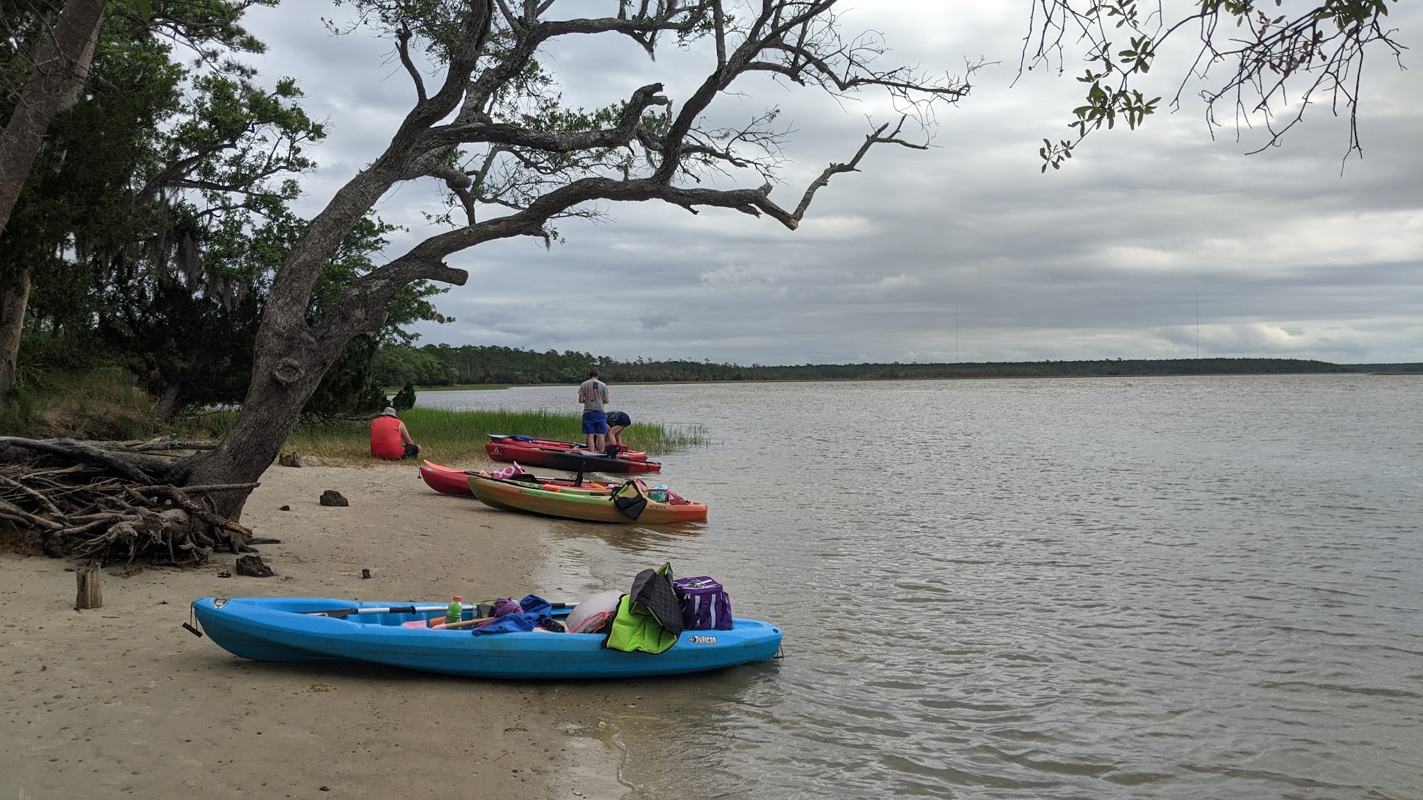
- Put in/Take Out: cement ramp
- Conveniences: none
- Best Features: Time the tides right for some easy miles
- Worst Features: Watch out for the wind!
- Wildlife spotted: Herons, egrets
- Vegetation: Marsh grasses
- Primary Author: James

Some of our adventures are grand adventures and others swiftly devolve into cautionary tales. Our paddle to Cat Island fits a little into each category.

We often kayak with my sisters Gina and Joy and it was Gina who first heard about Cat Island on the Wando River just north of Charleston. The Wando is a big, broad tidal river lined with houses for much of its length, but Cat Island is a marshy, muddy undeveloped stretch of land with a tiny beach of sand. Reading reviews, we saw that this small stretch of beach is a good place to find sharks teeth. Also in the reviews were warnings that we'd need to time our trips to match the tides. Launch at Paradise Island boat ramp when the tide is going out and you'll be carried down river to Cat Island. Wait until the tide shifts and ride the tide back. Easy!

The day started promising. The boat ramp itself is a little tricky to find if you aren't using Google maps. We've been there twice and didn't spot a sign for it on Highway 17 either time. The ramp itself is somewhat rustic, concrete that's being reclaimed by river mud and shells. There are no conveniences at the ramp like water, restrooms, or even picnic tables, but this is fairly common. In all, it's a perfectly fine place to launch a kayak.

Phase one of our plan, to ride the outgoing tide to Cat Island, went well. The current moved swiftly, and we could see more and more riverbank being exposed. There's no real danger of getting stranded by the low water, but I was worried that we might be dragging out kayaks through mud once we reached Cat Island.

But, we finished our ride there as the tide was going slack. Minutes after we arrived, the waves were lapping at the back of our kayaks on the shore and we had to drag them up higher. We were the only people on the little Cat Island beach that morning, which turned out to be a good thing, since there's really not a whole lot of beach there. We did find plenty of shark's teeth once we got our eyes dialed in on the shapes. Alas, they were all tiny, none bigger than half an inch, most much smaller. When I gave up looking for teeth, I explored the solid parts of the island, which turns out to be not much, maybe fifty feet across and a few hundred feet long. The opposite side was a big marsh with numerous egrets and herons, but they were too distant to really photograph.
One concern I had paddling out was that we might have to wait a long time for the tide to turn. Nope! In a little under an hour, the water was rising swiftly, wiping out the beach. It was time for our return trip.

That's when we discovered that the tides weren't the trickiest part of this voyage. The water was moving in the right direction, but it was opposed by a wind blowing the opposite direction, creating very choppy water. This was also a good opportunity to appreciate how sail boats work, since the wind blowing against the parts of our bodies and boats above the water easily overpowered the water pushing against our hulls. Needless to say, the nearly four mile paddle back was grueling, and if photos on this post are a little skimpy it's partly because not once during the paddle back could I take my hands off the paddle. You were either paddling forward, or the wind was pushing you backward.
By the time we got back to the boat ramp, it felt like a completely different river. All the exposed banks were submerged and docks we could have paddled under standing up were mere inches above the waves. The water was so high we were even worried it might flood the parking lot of the boat ramp, but, fortunately, when we arrived the parking lot was still dry. Still, I imagine that under particularly strong high tides, this boat ramp is probably submerged, so definitely do your research before launching from here!
If we return, we likely wouldn't try for Cat Island again. The Wando continues on up from the boat ramp, narrow and twisting through marshes. It looks like a tempting place to paddle into on a rising current. Just, you know, not on a windy day.