Wednesday, May 27, 2020

Hiking in Duke Forest - Hillsborough Division


  • Dates Hiked: April 14, 19, 27,and May 26, 2020
  • Posted length: n/a
  • Total miles Tracked: 4/14/2020: 2 miles; 4/19/2020: 3.7 miles; 4/27/2020: 1.75 miles, 5/26/2020: 2.5 miles
  • Type of Trail: gravel and dirt roads, foot trails
  • Conveniences: Close to home
  • Best Features: Solitude
  • Worst Features: No water, no parking
  • Wildlife spotted: song birds, tortoise, winged insects
  • Vegetation: Pines and hardwoods, wildflowers
  • Associated Website: https://dukeforest.duke.edu/
  • Primary Author: Cheryl

This spring, as Covid-19 has shut our world down, more people have also ventured outside for exercise and vitamin D.  This became increasingly difficult as state and local parks had to shut their gates due to over-crowding and the inability for people to practice social distancing.  We are very lucky that in addition to the abundance of state parks we have here in this area, we also have a multitude of other trails at our disposal - if you just know where to find them.

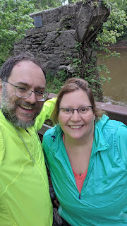
James and I have spent a lot of time walking and exploring the many different divisions of Duke Forest.  We almost hate to share this gem of a trail right here in Hillsborough, but it's so worth checking out.  In four times we've gone and hiked this one trail, we've only encountered one other person.  Social distancing for the WIN!

We're sure that the name "Snake Foot Trail" is in no way connected to the lack of visitors.


The purpose of Duke Forest is not for recreation.  It is a cumulative total of over 7000 acres of a large outdoor laboratory for research that has been in operation for nearly 90 years, and has land in Durham, Orange and Alamance Counties.  While Duke Forest stresses education and research,  they know the land is also well loved by the community for hiking (and on some gravel roads in some of the divisions, for biking). Because Duke Forest has experienced an increase of usage of the roads and foot trails during this pandemic, they're gathering stories and personal reflections from the public to document what the Forest has meant to the users.  Go to the link above to find the survey. Always researching!

This section of the Hillsborough Division is off of the connector between north bound I-85 and Highway 70 East.  There is just enough room for 2 cars to park on either side of the gate.  Most of our recent hikes here have been in the evening, as the sun casts long shadows through the old growth.  


The traffic from the nearby interstate is audible, but that is easily shut out while you search for the remnants of old paved roads along the foot trails.  Snake foot trail loops around and intersects with the Old Quarry Road, then you're routed back to Cates' Road to complete your loop. 


Look for all the winged creatures.


And check out what's booming above your head and below your feet.  


Things that grow tall, and things that grow small. 

Thistles that bristle.


And feathery fringes.

Turkey tails and tortoises with shells. 


Take in the all the solitude that the forest can give.

Biking the Dunn-Erwin Rail Trail, Cape Fear River Connector, and Buffalo Creek Greenway

  • Date Biked: April 25, 2020  
  • Posted length: Dunn Erwin Rail Trail:  5.3 miles;  Buffalo Creek Greenway:  ~ 3 miles
  • Total miles Tracked: 14.9 miles (Dunn-Erwin) and 5.9 miles (Buffalo Creek)
  • Type of Trail: Rail trail and Greenway
  • Conveniences:  In non-Covid times, there are bathrooms at the Cape Fear parking lot and at the terminus of the Buffalo Creek Greenway in Smithfield
  • Best Features: Great scenery, small town access
  • Worst Features: Poor road markings between the Dunn-Erwin Trail and the Cape Fear Trail
  • Wildlife spotted: None
  • Vegetation: Pines and hardwoods, wildflowers
  • Additional Information: Met the Mayor of Erwin
  • Associated Website: http://www.harnett.org/parkrec/dunnerwin-rail-trail.asp and https://www.smithfield-nc.com/page/srac_buffalo_creek
  • Primary Author: James

North Carolina has a nice, long continuous segment of the East Coast Greenway. You can start riding in downtown Durham and stay on connecting greenways all the way to Clayton. After that, the next little section of completed greenway is less than an hour's drive away, the Dunn-Erwin Rail Trail. We actually went looking for this trail once driving back from Myrtle Beach. We made the mistake of going to the Dunn end. There was no trailhead parking lot, and what trail we could locate was overgrown and sketchy looking, so we gave up. 

This April, in the interest of biking every last segment of greenway available to us in North Carolina, we took another stab at it, this time starting in Erwin. What a difference! The trail goes right through the center of the small town, ending at a small park with a gazebo. Covid19 had shut the town down, but there were small restaurants and shops that looked like pleasant places to visit post ride in more normal times. There was a nice large sign with a trail map at the start of the trail. If you plan to ride this trail, this is definitely the place to start. 

When we arrived, I discovered that one of my tires was flat. We sat at a bench to change tubes, and an SUV with two women pulled up. They got out and picked up the bench next to us and started loading it into their vehicle. One of the women explained it was okay, they weren't stealing it. She was, in fact, the mayor of Erwin. We aren't often greeted by the mayors of the small towns we bike through, so this was a nice bonus. She also told us to make sure we biked the Cape Fear River Trail while we were in town. This wasn't a trail that showed on Google maps, but she said that the connector had just recently been finished. We told her we'd check it out and we parted ways. We had trails to explore and she had someplace in urgent need of a bench, apparently. 


It's about five miles to Dunn, and it may well be the easiest five miles of biking on the planet. There is zero question that you're on a former rail bed. The path is very flat and very straight. It crosses a few roads, but most weren't particularly busy. The path is crushed gravel, but it's firmly packed and not at all difficult until you get to about a mile from Dunn, where it starts getting a bit grassy and rutty. Still, you don't need a mountain bike for this, a road bike would handle the surface fine. I would also imagine this would be a good trail for kids. It wasn't crowded at all, and unlike some rail trails there were hardly any embankments. Kids losing control of bikes and rolling down steep embankments is something we've seen more than once on our adventures. This wouldn't be a problem here.


The one tiny thing that might be a problem are the embedded milestones in the middle of the trail. Fortunately, these don't extend the full length of the trail, and I'm sure that the most raised of them on rose about an inch above the road bed, but the trail is otherwise so flat the seemed more like obstacles and helpful information. 


Don't let the fact that this trail has no elevation gain or loss and only one real curve lead you to believe it's boring to ride. Once you get out of Erwin, you're passing mainly through farmlands and the occasional wetlands. It's quite peaceful, with plenty of wildflowers. 


Of course, a ten mile round trip even on a nice greenway doesn't justify packing up the bikes and driving over an hour to get there. Luckily, we had two bonus trails! The first is the one the mayor told us about, the Cape Fear River Trail. This is a fairly short trail next to the river, in theory. The trees are pretty thick along the trail, so there's only a few places to catch glimpses of the river itself. The trail ends at a park with bathrooms and a gate leading to a kayak/canoe access. It's definitely worth tacking on when you ride the Dunn-Erwin Trail, giving you a few more miles of biking. Make sure you take a picture of the map! To reach the Cape Fear Trail, you're riding on roads through a neighborhood. Traffic is no problem, but not all the turns you'll need to make were particularly well marked. The trail turns off just past a water treatment plant and it's easy to miss, leaving you biking down a dead end road wondering what went wrong. Also, unlike the rail trail, reaching the river involves some serious downhills and uphills. Fortunately, it's worth the ride. 


But wait! There's more! As long as we were in the area, we drove about twenty minutes to downtown Smithfield, to ride the Buffalo Creek Greenway. This is a short trail, only three miles. It's a paved trail next to the Neuse, and it's quite lovely. Mile zero has a graveyard on one side of the trail and a playground on the other, so it's a good place to remind you of how fun it is to play outside, and also that one day, you'll die. With thoughts of your own mortality to spur you onward, you swoop down a winding path to the river. In less than a mile you're riding past the downtown. Again, everything was closed due to Covid, but there are restaurants and shops and historic sites right off the path that we'd want to check out if we ever return.


Honestly, the only real drawback to the greenway in Smithfield is its brevity. I can only hope that one day it will wind up connecting the Neuse River Trail, which really isn't that far upstream. Being able to bike from Durham to Smithfield, then maybe on to Erwin and Dunn, without worrying about cars would be amazing. For now, I don't know that we'd make a special trip to bike the Buffalo Creek Greenway again, but we'd definitely walk it if we were ever back in the area. 


Saturday, May 23, 2020

Biking on Roanoke Canal Trail

  • Date Biked: April 17, 2020
  • Posted length: Approximately 7.8 miles
  • Total miles Tracked: 18 miles 
  • Type of Trail: Canal towpath (comprised of dirt, rocks, roots and sweetgumballs)
  • Conveniences: Parking lots
  • Best Features: Amazing maps, Educational signage about trees and wildflowers (I'm looking at you wild buttercups and sneezeweed!)
  • Worst Features: questionable road crossings, in need of maintenance, very narrow in spots
  • Wildlife spotted: Bunny, goose
  • Vegetation: Hardwood forests, overgrown briers, wildflowers
  • Associated Website: https://roanokecanal.com/roanoke-canal-trail.html
  • Primary Author: James

When I told Cheryl I was interested in biking the Roanoke Canal Trail she assumed, naturally enough, that I was talking about a trail in Roanoke, Virginia. Nope! This is in the other Roanoke, Roanoke Rapids, North Carolina, situated on the Roanoke River near some, um, rapids. And it's because of those rapids that a system of canals needed to be built two-hundred years ago. Today, the towpath of the canal has been turned into what's billed as "North Carolina's longest museum," seven miles of nature and history that makes for a pleasant afternoon of riding and exploration. 


The first thing we explored on reaching Roanoke Rapids was lunch. We love local diners and the 2nd Street Lunch did not disappoint. It was takeout only due to statewide restrictions, but when we got there the parking lot was packed, a good sign. We ordered smoked sausage dogs and they were pretty amazing. We don't single out a lot of the places we eat on these journeys, but you owe it to yourself to give this place a try. Now, on to the actual ride:


We parked at the actual canal museum building. There are other trail heads, but this would be the place we'd recommend. Alas, the museum was closed, again due to state restrictions. We can't confirm it, but I'm certain in more normal times this would provide bathrooms and water fountains, and even closed there were still outdoor exhibits, including canal boats and a mural dedicated to the role the canal played as part of the Underground Railroad. There's also clear signage and maps. Good maps are oddly lacking on a lot of the trails we ride, but Roanoke Rapids has gone the extra mile by marking all the historic sites you'll come across as you ride on the map. The trail also lives up to it's "longest museum" designation with dozens of signs identifying local vegetation. We've biked better trails, but this one places near the top for being informative about the history and nature you're encountering. 


The trail also gets high marks for variety. No two miles are alike. Sometimes you're biking narrow paths through forests, other times you're passing through wide open fields, and, while most of it is flat, there are a few surprisingly steep hills. The surface can get really rough in some spots. This definitely isn't a good trail for a road bike. Also, there are plenty of places where two way bike traffic is nearly impossible. Be prepared to steer into weeds to let people pass. 


Though, as long as you're in the weeds, you may as well enjoy them. There were plenty of wildflowers, and the plaques we mentioned identify them all, from the pokeweed to the sneezeweed. It's really a "stop and smell the flowers" kind of ride. We even smelled the sneezeweed, and are a little disappointed we didn't sneeze afterwards. 


Obviously not a gate designed by a biker.

The vines actually grabbed her hard enough to throw her from her bike! Seriously, be careful 

But, it's not all flowers! There are also thorny vines! So be careful if you value your clothing or your skin, since they will grab you. We weren't sure if the Covid lock down and closure of the museum might be to blame for all the briers sticking out onto the trail. Perhaps in more normal times it's better maintained. 

As long as we're griping about things, the trail also has at least one entry with a gate far too narrow to ride a bike through, or even walk a bike through without some handlebar maneuvering. There's also a road crossing with no ramp onto the road, just a drop off a steep curve. These little details are especially frustrating because so much of the rest of the trail seems to have some real thought and attention put into it. 

Viaduct


The eastern end of the trail takes you to Weldon. Here's where the lock down really hurt, because there was a brew pub at the trail's end in an historic mill that looks like it would be a great destination. Weldon also a lot of history as a railroad town, and the downtown has some quirky architecture. The town seems to have put some effort into making itself an appealing destination for trail riders, and is one of the main reasons we'll definitely return. 


A final thought: One surprise of the Roanoke Canal is that we only rarely caught glimpses of the actual Roanoke River. But, it does seem like a potentially interesting destination for kayaking as well as biking, and the trail length would also make it a good walking destination. Leave a car in Weldon, park at the lake in Roanoke Rapids, and walk to the full length of just under seven miles. It's a great destination for bikes, boots, and boats!