Showing posts with label dam. Show all posts

Sunday, July 26, 2020

Biking the Neuse River Trail Greenway

  • Date Biked: May 25, 2020
  • Posted length: Neuse River Trail:  27.5 miles.  Clayton Riverwalk + Sam's Branch Greenway: 5.25
  • Total miles Tracked: 68 miles 
  • Type of Trail: paved greenway
  • Conveniences: Parking lots
  • Best Features: Only two road crossings the whole length. Plenty of access points. 
  • Worst Features: Very few bathrooms or water stations near the trail, especially the southern portion. Sometimes crowded. 
  • Wildlife spotted: It's common to see deer, rabbits, herons, snakes, turkeys and turtles. 
  • Vegetation: Hardwood forests, overgrown briers, wildflowers
  • Associated Website: https://raleighnc.gov/places/neuse-river-greenway-trail
  • Primary Author: James

The Neuse River Trail is, in our opinion, the best overall greenway you can bike in North Carolina. It's the longest continuous greenway in the state at 27.5 miles, and flows seamlessly onto the Clayton Riverwalk, which connects to the Sam's Branch Greenway, for very close to 33 miles of trail. It was designed like a bike interstate; there are underpasses and overpasses to get you past intersecting roads, so that on the whole length you only have two roads where you might encounter cars. There's a short bit of road that takes you into Anderson Point Park, and you also cross Brownfields Road, where I can't recall ever encountering a single vehicle. If you enjoy riding without once worrying about traffic, this is as good as it gets. 

Taking you above and below existing roads, you can bike for miles without worrying about cars. 


At least, you don't have to worry about cars. Foot traffic and bike traffic are a different issue. The trail is fairly wide for a greenway, but bikes share the path with runners and walkers, and sections of the trail can be downright congested, especially on Saturday mornings. 

But, even on a crowded Saturday, one of the best parts about riding the Neuse is that it's not just bikers that enjoy the absence of traffic. Ride for any distance at all, especially early morning or later in the evening, and it's almost a guarantee you'll see wildlife. Deer are abundant, rabbits are pretty common, and herons are easy to spot during the summer. Wild turkeys tend to show up on the southern sections. There's enough wildlife that, when we took a picture of some wild turkeys in a fields, they got photobombed by a deer. The trail also makes snakes feel at home, so keep your eyes open for copperheads. 

There are so many deer along this trail they sometimes turn up in photos uninvited! 
We ride the Neuse frequently. Given its length, it offers several convenient rides. Out and back the full length is certainly doable during the spring and fall. Things get a bit trickier in the full heat of summer because one area where the Neuse falls short is in water stations. There are bathrooms and fountains at Anderson Point Park, which is located between miles 17 and 18. There's also bathrooms and a fountain at mile 0, at the Falls Lake Dam. And in between... nothing, at least not directly on the trail. There's a few spots where you can detour away and reach a good breaking area in less than a mile between the dam and the park. One of our favorites is a spur at Trailhead Lane. You can follow this to an apartment complex, and next to that there's a Sheetz. South of Anderson Point Park, alas, is a journey for people with strong bladders. There are zero restrooms along the trail. There are, however, miles and miles of rolling landscape that make you feel far removed from the large city only a few miles distant. 

Come for the bathrooms, stay for the birdhouses! 


Usually, we park at Anderson Point Park and ride either the northern section or the southern section, and add it little connecting greenways to get in about 40 miles of riding. North of Anderson Point Park, you encounter the Mingo Creek Trail, the Smith Creek Greenway, and the Abbotts Creek Trail. The Mingo Creek is the longest, at just over 3 miles, and has some nice boardwalks through wetlands. The Smith Creek Greenway looks like it's planned to eventually connect to a longer greenway, and has an impressive bridge to ride across, but is mainly just a mile through backyards of recently built houses. Abbotts Creek Creek is only about a mile before it hits Falls River Avenue, and is one of the most wildlife rich places you can ride. Your odds of seeing deer here are very high, and even if the deer aren't around the boardwalks will take you over wetlands full of wildflowers. 

Also some truly enormous butterflies.
Speaking of wildflowers, around mile 15, near the site of the old Milburnie Dam, there's was an impressive display when we biked in May, and there are fields south of Anderson Point Park brimming with flowers. In Anderson Point Park itself there's a large meadow, and numerous magnolia trees. Anderson Point Park is also the start of the Crabtree Creek Greenway. Currently, you can bike out about 6 miles before it's shut for maintenance. Two miles south of Anderson Point, you'll encounter the Walnut Creek Greenway, which is over ten miles long, but shows it's age after the first three or four miles. Still, between the Neuse and the connecting greenways, it really wouldn't be difficult to put together 100+ miles of biking without hardly any road crossings. 


A final note is that the Neuse is a segment of two larger trails. The full length is part of North Carolina's Mountain to Sea Trail. South of Walnut Creek, the Neuse is also part of the East Coast Greenway, which will one day be a series of greenways from Maine to Florida. North Carolina has one of the longest continuous segments, allowing you to bike from the center of Durham all the way to Clayton with nearly all of the distance on greenways or park roads. 


Cheryl and I feel very lucky to have a greenway with such a great length and design less than an hour from our house. The Neuse wasn't completely finished when we first started biking, and, much like the American Tobacco Trail, the the trail kept getting longer which pushed us to keep biking further. The fact that both trails are now fully linked up by connecting trails makes the Triangle one of the best places you could want to live if you enjoy biking. 


Monday, June 15, 2020

Biking the Lynchburg VA Trail system

  • Date Biked: May 2, 2020
  • Total miles Tracked: 19.85 miles 
  • Type of Trail: Greenway
  • Best Features: Long trail road tunnels and bridges
  • Worst Features: Creekside trail is very rugged
  • Wildlife spotted: None
  • Vegetation: Pines and hardwoods, wildflowers
  • Associated Website:https://www.lynchburgparksandrec.com/trails/
  • Primary Author:  James

They Lynchburg greenway and rail trail system doesn't pop up if you're googling for long greenways, which is a shame, and something of a branding problem. Lynchburg's trail system is mostly interconnected and cumulatively adds up to permit 20 miles + of biking without ever once needing to ride on a road. But, rather than advertise it as one big trail, it gets promoted as a bunch of little trails: The Riverwalk Trail, the Blackwater Creek Trail, the Kemper Station Trail, and the Point of Honor Trail. There's also several unpaved mountain bike trails connecting to this, including the Creekside Trail, which has a very rough and rocky access but then flattens out into a fairly nice ride. If you're like us, you might not be motivated to load up your bikes and drive two hours to ride the three mile long Blackwater Creek Trail, or even the 6.5 mile Riverwalk. Once you discover that these are really one long greenway, the destination becomes more tempting. 


You should give in to that temptation! First, downtown Lynchburg is near the hub of three of the trails, and it's a wonderful, walkable historic area, with plenty of restaurants catering to people who've come downtown for recreation. It's a very nice blend of the old and the new, and Lynchburg gets high marks as a town that seems to really appreciate the users of its greenways. 


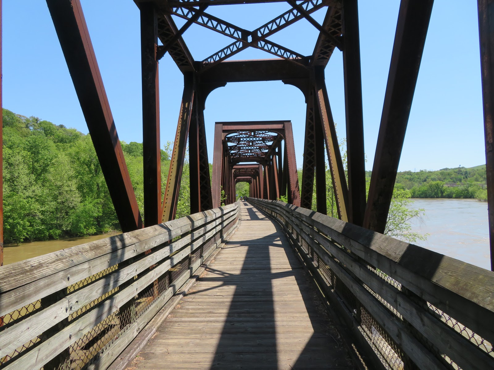
Another nice feature of the rail trail segments of the trail system is that Lynchburg is still very much an active railroad hub. You'll almost definitely encounter trains if you're in the area for any length of time at all. And, the rail trail makes use of some fantastic relics from it's previous life, including the Hollins Mill Tunnel on the Blackwater trail and a big trestle bridge on the Riverwalk at the end of Percival's Island.  


There are numerous trail access points, but the best two we've found are the Awareness Garden at mile 0 of the Blackwater Creek Trail, which has bathrooms and a water fountain, and the downtown parking for Percival's Island, which you'll recognize by Lynchburg's "LOVE" sign. No bathrooms or water here, alas, but it does give you easy access to the part of the trail that runs downtown. 


The trails do have a few challenges. The Kemper Station Trail is short, but a real work out, pretty much a continuous uphill grade, though it is fun to zip back down. We didn't ride the full length of the Creekside Trail because it was very muddy, probably because, you know, it's beside a creek, and it was spring time, and there was evidence that parts of this trail are probably underwater for parts of the year. Speaking of being underwater, the Point of Honor Trail crosses a spillway just beneath a dam. We wound up walking our bikes across because the water looked pretty swift, though in retrospect riding through it wouldn't have been any particular challenge. Even if you don't get wet here, prepare to be dripped on in the Hollins Mill Tunnel, which was pretty wet the day we visited. I imagine as we move deeper into summer the trail system will be dryer,


One final recommendation of the trail system is that it's got a nice variety to it. On Percival Island, the trail is flat and straight and rolling through forest and fields, while the Blackwater segment is full of deep railroad cuts, the tunnel, and is generally steeper. I'm hard pressed to think of another trail that packs in such a wealth of different scenes into so few miles. 


The LOVE sign on the Riverwalk features bike wheels, boot prints, kayak paddles and skate wheels. It pretty well sums up our feelings about this trail. It's just a lovely place to spend a day engaging in one or more these activities. 

Saturday, May 23, 2020

Biking on Roanoke Canal Trail

  • Date Biked: April 17, 2020
  • Posted length: Approximately 7.8 miles
  • Total miles Tracked: 18 miles 
  • Type of Trail: Canal towpath (comprised of dirt, rocks, roots and sweetgumballs)
  • Conveniences: Parking lots
  • Best Features: Amazing maps, Educational signage about trees and wildflowers (I'm looking at you wild buttercups and sneezeweed!)
  • Worst Features: questionable road crossings, in need of maintenance, very narrow in spots
  • Wildlife spotted: Bunny, goose
  • Vegetation: Hardwood forests, overgrown briers, wildflowers
  • Associated Website: https://roanokecanal.com/roanoke-canal-trail.html
  • Primary Author: James

When I told Cheryl I was interested in biking the Roanoke Canal Trail she assumed, naturally enough, that I was talking about a trail in Roanoke, Virginia. Nope! This is in the other Roanoke, Roanoke Rapids, North Carolina, situated on the Roanoke River near some, um, rapids. And it's because of those rapids that a system of canals needed to be built two-hundred years ago. Today, the towpath of the canal has been turned into what's billed as "North Carolina's longest museum," seven miles of nature and history that makes for a pleasant afternoon of riding and exploration. 


The first thing we explored on reaching Roanoke Rapids was lunch. We love local diners and the 2nd Street Lunch did not disappoint. It was takeout only due to statewide restrictions, but when we got there the parking lot was packed, a good sign. We ordered smoked sausage dogs and they were pretty amazing. We don't single out a lot of the places we eat on these journeys, but you owe it to yourself to give this place a try. Now, on to the actual ride:


We parked at the actual canal museum building. There are other trail heads, but this would be the place we'd recommend. Alas, the museum was closed, again due to state restrictions. We can't confirm it, but I'm certain in more normal times this would provide bathrooms and water fountains, and even closed there were still outdoor exhibits, including canal boats and a mural dedicated to the role the canal played as part of the Underground Railroad. There's also clear signage and maps. Good maps are oddly lacking on a lot of the trails we ride, but Roanoke Rapids has gone the extra mile by marking all the historic sites you'll come across as you ride on the map. The trail also lives up to it's "longest museum" designation with dozens of signs identifying local vegetation. We've biked better trails, but this one places near the top for being informative about the history and nature you're encountering. 


The trail also gets high marks for variety. No two miles are alike. Sometimes you're biking narrow paths through forests, other times you're passing through wide open fields, and, while most of it is flat, there are a few surprisingly steep hills. The surface can get really rough in some spots. This definitely isn't a good trail for a road bike. Also, there are plenty of places where two way bike traffic is nearly impossible. Be prepared to steer into weeds to let people pass. 


Though, as long as you're in the weeds, you may as well enjoy them. There were plenty of wildflowers, and the plaques we mentioned identify them all, from the pokeweed to the sneezeweed. It's really a "stop and smell the flowers" kind of ride. We even smelled the sneezeweed, and are a little disappointed we didn't sneeze afterwards. 


Obviously not a gate designed by a biker.

The vines actually grabbed her hard enough to throw her from her bike! Seriously, be careful 

But, it's not all flowers! There are also thorny vines! So be careful if you value your clothing or your skin, since they will grab you. We weren't sure if the Covid lock down and closure of the museum might be to blame for all the briers sticking out onto the trail. Perhaps in more normal times it's better maintained. 

As long as we're griping about things, the trail also has at least one entry with a gate far too narrow to ride a bike through, or even walk a bike through without some handlebar maneuvering. There's also a road crossing with no ramp onto the road, just a drop off a steep curve. These little details are especially frustrating because so much of the rest of the trail seems to have some real thought and attention put into it. 

Viaduct


The eastern end of the trail takes you to Weldon. Here's where the lock down really hurt, because there was a brew pub at the trail's end in an historic mill that looks like it would be a great destination. Weldon also a lot of history as a railroad town, and the downtown has some quirky architecture. The town seems to have put some effort into making itself an appealing destination for trail riders, and is one of the main reasons we'll definitely return. 


A final thought: One surprise of the Roanoke Canal is that we only rarely caught glimpses of the actual Roanoke River. But, it does seem like a potentially interesting destination for kayaking as well as biking, and the trail length would also make it a good walking destination. Leave a car in Weldon, park at the lake in Roanoke Rapids, and walk to the full length of just under seven miles. It's a great destination for bikes, boots, and boats!