Showing posts with label history. Show all posts

Sunday, June 25, 2023

Biking the GAP Trail Part 4: Meyersdale to Cumberland

  • Dates Biked:  April 6&7, 2023
  • Posted Mileage: Milepost 36 in Garrett to Milepost 0 in Cumberland, MD
  • Total miles Tracked: 9.57 Thursday, 35.67 Friday
  • Type of Trail: Rail trail, crushed surface
  • Conveniences: Trailheads with bathrooms along the route, plus restaurants and lodging adjacent to the trail in Meyersdale, Frostburg, and Cumberland
  • Best Features: The continental divide, the bike sculptures of Frostburg
  • Worst Features: It's quite a trek up to Frostburg! 
  • Wildlife spotted:  None
  • Vegetation: Hardwoods, wildflowers
  • Associated Website: Great Allegheny Passage (gaptrail.org)
  • Primary Author:  James

As mentioned in the previous post, the forecast for Wednesday had been cold, wet, even snowy, only to shift at the last second to a warm and beautiful day. But, the cold and damp had merely been delayed by a day. Thursday the rains came, and temperatures plunged. It didn't reach snow conditions, but it did give us an excuse to take our time leaving the Bright Morning B&B. We stopped at a laundromat in West Newton and took care of three days of sweaty bike clothes, then did a leisurely, foggy drive through Amish farmlands among high hills as we navigated to our next lodging, Yoder's Guest House in Meyersdale. This is the last sizable town on the trail before you reach Maryland, and, like Bright Morning, Yoder's was full of fellow trail riders. 


After we settled in, the rain finally came to a chilly end, so we took the opportunity to ride a few miles west to reach the town of Garrett. This was a nice, easy ride, and if the weather had been five degrees warmer we might have pushed a little further. As it was, we headed back to get a good night sleep and prep for Friday's ride. 


Friday, we drove down to Cumberland to Wheelzup at Canal Place, where we'd hired a shuttle to drive us back to Meyersdale. Meyersdale to Cumberland would be an extremely tough ride to do as an out and back, because, once you pass over the continental divide, the trail goes into a very steep downhill, and the thought of riding back up it was intimidating. It apparently intimidates many people. Dozens of bikers were heading down the mountain, but I only remember passing two or three heading uphill. 


Not that this route avoids uphill! You still need to get to the Continental Divide, and it's a non-stop climb from Meyersdale. It's not that steep or long, but on our fifth day of biking, with temps in the 30s, it was probably the most challenging section of our trip. 


Then... you reach the top! You're 23 miles from Cumberland, but it's all downhill at a fairly steep grade, and a daredevil could probably cover these miles in an hour, definitely in a hour and a half. But don't race down it! You'll miss some great sights! The Big Savage Tunnel is just a few miles away, the longest railway tunnel on the whole GAP.


Beyond this, you'll pass over the Mason-Dixon line, and it would be a wasted opportunity not to ride along the pavement marking with your tire straddling Pennsylvania and Maryland. 


Seriously, you can pick up some real speed on this section! 


After that, you need to stop in Frostburg. Adjacent to the trail is a park full of bike-themed sculptures. Ride to the top and you'll find a staircase leading up into town. We were hoping for a cup of coffee to take the chill off, but, alas, all the coffee shops were closed by the time we got there. Early afternoon is not a happening time of day in Frostburg. It's still a cute town, though. 


This is an omen for those who think they'll be riding their bike all the way into Frostburg.


The rest of the ride is scenic, with most of this rail trail adjacent to actual rails. As you come around the curves you'll be treated to multiple vistas showcasing this beautiful landscape. 

Zoom!

Hold on, I've accidentally gabbed someone else's bike. 


On day 5 of riding, being able to coast standing up for several miles is really nice. 


Finally, as nice as the ride has been, you can roll into Cumberland where you'll find the official mile 0 gateway, plus numerous restaurants and bars welcoming riders. It's a great way to wrap up a week of biking! 


For day one on the GAP, click here!

Wednesday, June 14, 2023

Biking the GAP Trail Part 1 - Pittsburgh

  •  Date Biked:  April 3, 2023
  • Posted Mileage: NA
  • Total miles Tracked: 12.67
  • Type of Trail: Rail trail, city greenway, streets
  • Conveniences: Along the route you'll find public restrooms and water, plus plenty of restaurants
  • Best Features:  Pittsburgh! This is a great sightseeing ride of the waterfront.
  • Worst Features:  Chaos! Trail closures, traffic, and crowded paths make this a stressful ride at times.
  • Wildlife spotted:  None
  • Vegetation: Nothing noteworthy
  • Associated Website: Great Allegheny Passage (gaptrail.org)
  • Primary Author:  James

One of the advantages of traveling to promote my books is that our journeys take us near trails far removed from our normal range of exploration. The Steel City Con at the beginning of April gave us the opportunity to ride one of the trails that has been on our list for years, the GAP, aka the Great Allegheny Passage. This is a rail trail stretching from the center of Pittsburgh, covering 150 miles to Cumberland Maryland, where it meets up with the C&O Canal Trail, which covers another 180 miles into Washington DC. In theory, you can ride from Pittsburgh to Washington without ever being on roads with cars.


In practice, maintenance on 330 miles of continuous trail effectively chops the trail into disconnected segments depending on the time of year you're riding. The website informed us of several miles of closures in early April. Given the remote and rugged nature of much of trail, detours via bike are impractical, and you're unlikely to get cell signal to call for a shuttle service in many areas. You'll either need to make use of a bike outfitter that can meet you a planned times and places to shuttle you between segments, or else you'll need to tackle this trip as a lot of out-and-backs. Cheryl and I chose the second option, riding most of the GAP over four days. 


Day one, we decided to focus on downtown Pittsburgh. The trail is closed right before you reach downtown and requires detouring onto actual roads. We were nervous about this part of the ride, but the town had lanes set aside that only bikes and busses can travel, so we were never in any danger from traffic. On the other hand, downtown Pittsburgh is a mishmash of one-way streets and the detour wasn't marked as clearly as it could have been. We wound up abandoning bike lanes and just walking for a few blocks on sidewalks, since this felt less stressful.


Even with the hassle of detours, riding the waterfront trails in Pittsburgh is a great experience. The GAP overlaps and intersects the Three Rivers Heritage trail, so you can cover quite a bit of distance. We started our day on the south side of the Monongahela River. We began by riding the Duquesne Incline, which will give you a fantastic view overlooking downtown, as well as provide an interesting perspective on the public transportation of the not-so-distant past. 

Fancy!

They didn't actually build this so that tourist could enjoy a view, but it's nice that they found an excuse to keep it running. 


In theory, you could ride from the incline to downtown with only a small section of road travel required, but we chose to drive from the incline to the Three Rivers Trail parking lot beneath the Birmingham Bridge. From there, we rode toward the Hot Metal Bridge, which was once an essential part of the steel industry. Along the path you'll find monuments to the industry, and access points leading to restaurants and shops. The bridge itself is an astonishing structure, a testament to the engineering prowess of previous generations. 


Once you're across the bridge, you'll be riding next to and under a busy interstate. This is a noisy, not terribly enjoyable experience. Fortunately, it only takes a few minutes before you're actually downtown. We didn't take many pictures of our effort to navigate the city streets, since we were kind of busy figuring out where, exactly, we were supposed to go. But, there's barely a quarter mile to cover in order to reach Point State Park. The official mile 0 of the GAP is in front of the park's huge fountain. No doubt it would probably have been quite impressive, if it had been running. Fortunately, the truly important waterworks, the public restrooms, were open, operating, and quite clean. 

Even more impressive with water! 

From your vantage point at the fountain, you'll be able to see across the river to stadiums and museums. You can reach these via the Fort Duquesne Bridge. The bridge takes you to an area full of bars and restaurants, and the trail runs for a few miles on both directions on this side of the river. We rode just far enough to get a picture of the submarine docked outside the science center, then took a few photos of the skyline, before grabbing lunch and heading back to our car. 

Going to a mountain town to look at a submarine feels counterintuitive.  

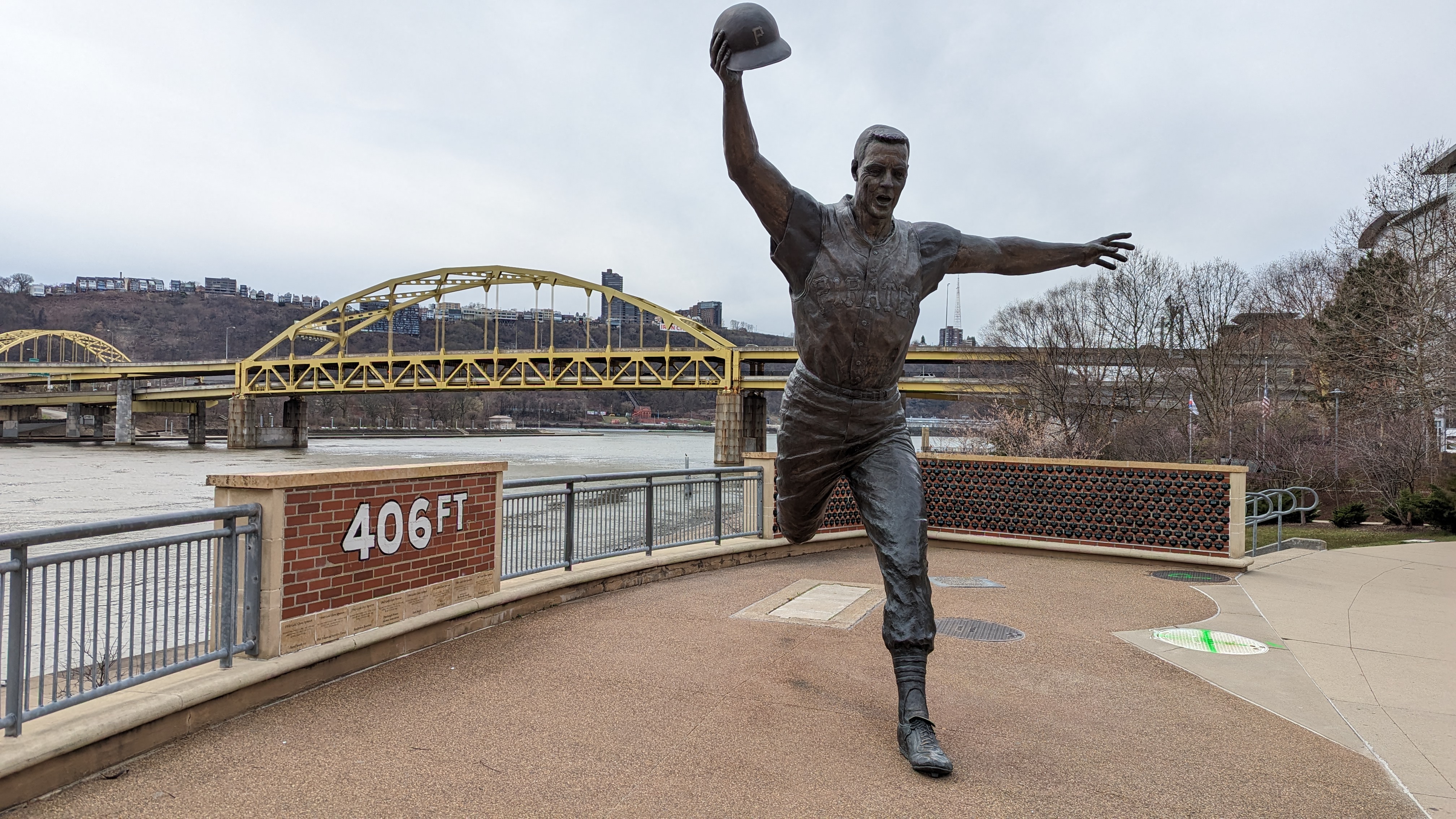
I don't know anything about sports. I assume this a monument commemorating a guy who threw his hat 406 feet. Impressive! 


This sign makes the trail look steeper than it really is. 

We still had to drive to the bed and breakfast we'd reserved for the next leg of our trip, and we planned to do a sunset ride once we reached that destination, so we didn't have time to linger. If we do this again, I'd definitely be interested in exploring more of the Three Rivers Trail, and would likely follow the GAP further down the south side of the river. That said, Pittsburg is really its own experience. The rest of the GAP has its own personality, which we'll be talking about in upcoming posts! 

Biking the Tobacco Heritage Trail, South Boston, Va


  • Date Biked:  September 3, 2022
  • Posted Mileage: 4 miles
  • Total miles Tracked: 9.2
  • Type of Trail: Rail trail, crushed gravel
  • Conveniences:  A few benches and picnic tables along the trail. 
  • Best Features:  Historical sites
  • Worst Features:  short ride, no trail-town feel
  • Wildlife spotted:  Rough green snake
  • Vegetation: Hardwoods, wildflowers
  • Associated Website: https://tobaccoheritagetrail.org/
  • Primary Author:  James

The largest chunk of the Tobacco Heritage Trail runs between La Crosse and Lawrenceville, Virginia. We've biked it a few times, and wrote about it in this previous post. But, there's another finished segment a few dozen miles away in South Boston. It's a little over 4 miles long, and most of it is a rail trail, flat and straight, making for an easy, if somewhat short, bike ride. 


The dedicated trailhead is at Cotton Mill Park, off Railroad Street. There's plenty of parking, but that's about it. A few benches, no water fountains or restrooms. 


You ride from this along a path that takes you to the old rail bed portion of the trail. You'll be turning right once you reach it, but you can also follow the path a little distance if you head left. You'll arrive at a historical site called Boyd's Ferry where there's a good view of a railroad bridge crossing the Dan River, plus a marker commemorating the Revolutionary War. 


Heading back onto the rail trail, you'll have roughly 3 miles of easy riding along a crushed surface. It's a nice, easy ride. There's plenty of wildflowers, but the landscape is a bit bland compared to most other Virginia rail trails. 


Fortunately, you don't need to stray far from the trail to find points of interest. About a mile from the end there's a turn off that leads to the Diamond Hill Cemetery, the graveyard for the Berry Hill Plantation, where you'll find a memorial to the enslaved people buried there.


As you head up the hill to the cemetery, you see another road leading further into Berry Hill. Follow this a hundred yards or so and you'll reach the brick ruins of the slave quarters. There are more roads leading further into the plantation but we didn't follow them. The cemetery is plainly open to the public, but we weren't certain if the larger plantation grounds were open. 


This portion of the Tobacco Heritage Trail is a good place to try out if you're just hungry for a good place to get in a bike ride, but South Boston doesn't seem to cater to trail riders. The trail is near downtown, but doesn't really pass through it, so it lacks the "trail town" feel of a town like Damascus or Farmville. On the plus side, since these trails aren't catering to tourists, the trails aren't crowded. It's a nice, peaceful getaway.