Showing posts with label paved. Show all posts

Wednesday, June 14, 2023

Biking the GAP Trail Part 1 - Pittsburgh

  •  Date Biked:  April 3, 2023
  • Posted Mileage: NA
  • Total miles Tracked: 12.67
  • Type of Trail: Rail trail, city greenway, streets
  • Conveniences: Along the route you'll find public restrooms and water, plus plenty of restaurants
  • Best Features:  Pittsburgh! This is a great sightseeing ride of the waterfront.
  • Worst Features:  Chaos! Trail closures, traffic, and crowded paths make this a stressful ride at times.
  • Wildlife spotted:  None
  • Vegetation: Nothing noteworthy
  • Associated Website: Great Allegheny Passage (gaptrail.org)
  • Primary Author:  James

One of the advantages of traveling to promote my books is that our journeys take us near trails far removed from our normal range of exploration. The Steel City Con at the beginning of April gave us the opportunity to ride one of the trails that has been on our list for years, the GAP, aka the Great Allegheny Passage. This is a rail trail stretching from the center of Pittsburgh, covering 150 miles to Cumberland Maryland, where it meets up with the C&O Canal Trail, which covers another 180 miles into Washington DC. In theory, you can ride from Pittsburgh to Washington without ever being on roads with cars.


In practice, maintenance on 330 miles of continuous trail effectively chops the trail into disconnected segments depending on the time of year you're riding. The website informed us of several miles of closures in early April. Given the remote and rugged nature of much of trail, detours via bike are impractical, and you're unlikely to get cell signal to call for a shuttle service in many areas. You'll either need to make use of a bike outfitter that can meet you a planned times and places to shuttle you between segments, or else you'll need to tackle this trip as a lot of out-and-backs. Cheryl and I chose the second option, riding most of the GAP over four days. 


Day one, we decided to focus on downtown Pittsburgh. The trail is closed right before you reach downtown and requires detouring onto actual roads. We were nervous about this part of the ride, but the town had lanes set aside that only bikes and busses can travel, so we were never in any danger from traffic. On the other hand, downtown Pittsburgh is a mishmash of one-way streets and the detour wasn't marked as clearly as it could have been. We wound up abandoning bike lanes and just walking for a few blocks on sidewalks, since this felt less stressful.


Even with the hassle of detours, riding the waterfront trails in Pittsburgh is a great experience. The GAP overlaps and intersects the Three Rivers Heritage trail, so you can cover quite a bit of distance. We started our day on the south side of the Monongahela River. We began by riding the Duquesne Incline, which will give you a fantastic view overlooking downtown, as well as provide an interesting perspective on the public transportation of the not-so-distant past. 

Fancy!

They didn't actually build this so that tourist could enjoy a view, but it's nice that they found an excuse to keep it running. 


In theory, you could ride from the incline to downtown with only a small section of road travel required, but we chose to drive from the incline to the Three Rivers Trail parking lot beneath the Birmingham Bridge. From there, we rode toward the Hot Metal Bridge, which was once an essential part of the steel industry. Along the path you'll find monuments to the industry, and access points leading to restaurants and shops. The bridge itself is an astonishing structure, a testament to the engineering prowess of previous generations. 


Once you're across the bridge, you'll be riding next to and under a busy interstate. This is a noisy, not terribly enjoyable experience. Fortunately, it only takes a few minutes before you're actually downtown. We didn't take many pictures of our effort to navigate the city streets, since we were kind of busy figuring out where, exactly, we were supposed to go. But, there's barely a quarter mile to cover in order to reach Point State Park. The official mile 0 of the GAP is in front of the park's huge fountain. No doubt it would probably have been quite impressive, if it had been running. Fortunately, the truly important waterworks, the public restrooms, were open, operating, and quite clean. 

Even more impressive with water! 

From your vantage point at the fountain, you'll be able to see across the river to stadiums and museums. You can reach these via the Fort Duquesne Bridge. The bridge takes you to an area full of bars and restaurants, and the trail runs for a few miles on both directions on this side of the river. We rode just far enough to get a picture of the submarine docked outside the science center, then took a few photos of the skyline, before grabbing lunch and heading back to our car. 

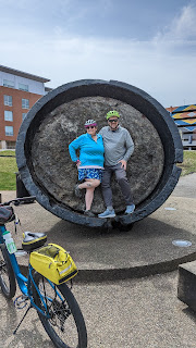
Going to a mountain town to look at a submarine feels counterintuitive.  

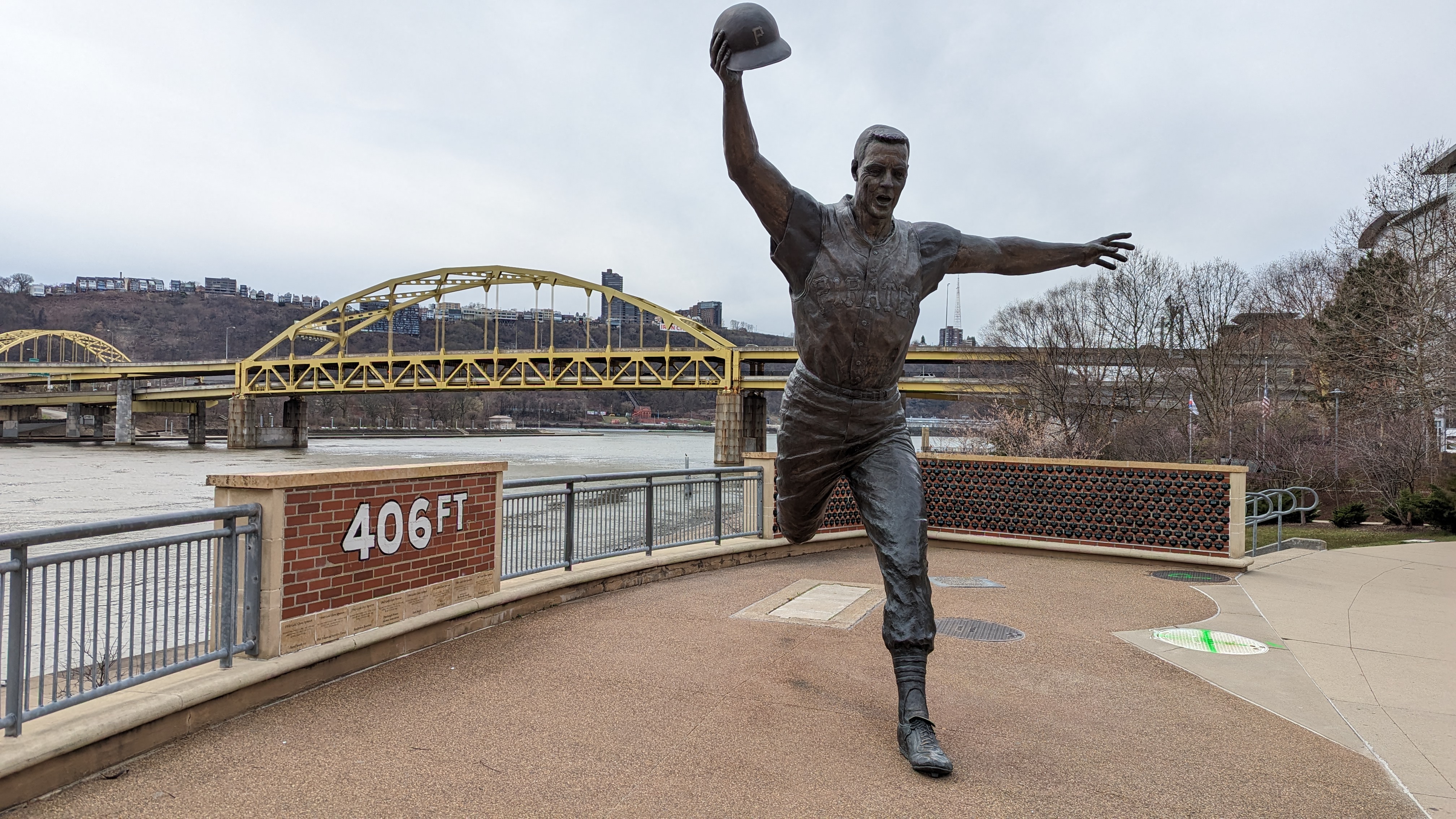
I don't know anything about sports. I assume this a monument commemorating a guy who threw his hat 406 feet. Impressive! 


This sign makes the trail look steeper than it really is. 

We still had to drive to the bed and breakfast we'd reserved for the next leg of our trip, and we planned to do a sunset ride once we reached that destination, so we didn't have time to linger. If we do this again, I'd definitely be interested in exploring more of the Three Rivers Trail, and would likely follow the GAP further down the south side of the river. That said, Pittsburg is really its own experience. The rest of the GAP has its own personality, which we'll be talking about in upcoming posts! 

Wednesday, December 15, 2021

Biking the Virginia Capital Trail from Williamsburg to Richmond

  • Date Biked:  September 20 , 2021 (with some photos from a ride in 2019)
  • Posted Mileage : 51.7 miles
  • Total miles Tracked: 53.19 miles
  • Type of Trail: Greenway, paved
  • Conveniences:  Picnic tables, plenty of parking at some trailheads
  • Best Features:   A high quality trail with a great length through multiple historic settings
  • Worst Features: Seldom far from traffic, very few public restrooms or water fountains
  • Wildlife spotted:  Deer
  • Vegetation: Hardwoods, pine, wildflowers
  • Associated Website:  https://www.virginiacapitaltrail.org/
  • Primary Author: James
If you enjoy reading plaques, have we got a trail for you!

Winding over 50 miles from Williamsburg to Richmond, the Virginia Capital Trail is a great destination trip for any biker. For experienced bikers, it's long enough to really test your endurance without dealing with too much traffic. The list of paved trails where you can do a century ride as an out and back and still have some miles to spare is a pretty short list! 

Mile 0.0

Not that we've tackled this as a century ride! There's no shuttle, but we had a friend of a friend ferry us down to Williamsburg after we left our vehicle at Shiplock Park in Richmond. We were dropped off in the parking lot of the Jamestown settlement. We were there before the visitor center opened, but have popped in before and it's a nice place to take a break, especially on a hot summer day. 

Since jets of water are shooting up among the sails, I assume this is some sort of monument to sinking ships. I probably should have read the plaque.

The ride out of Jamestown is very flat. There are a lot of historical markers, and the scenery is a mix of agricultural fields, wetlands, and residential areas. The first few miles have quite a few road crossings. Of note in this segment is Spoke & Art, a bike friendly coffee and treats place with exterior restrooms that are open even when the business is closed. 

Swamps are best viewed in the morning, before the mosquitos have their coffee. 


A few miles beyond this is the Chickahominy Riverfront Park and a semi-steep hill to climb on the arched bridge over the river, but the view at the top is worth the extra sweat. Once you're over the bridge, you pass through a lot of pine forest until you reach Charles City, which is around the 20 mile mark. Here you find another bike friendly restaurant, Cul's Courthouse Grill. They keep a thermos on the front porch for refilling water bottles, and after twenty miles of biking, you can eat a plate of fries mostly guilt free. 

There's an East Coast Greenway sign in the window, so you're technically haven't left the trail if you go inside Cul's for a beer. 


An important note: The trail kind of disappears in Charles City. It's not a huge problem if you are looking at the trail map on your phone, but could benefit from an extra sign or two to let you know you're on the right path while you're following the road through town. 

Right about here, they need a sign saying, "Keep going! You aren't lost!"

Though, seriously, they have great signs all along the trail with distances to upcoming destinations. More trails should make use of these!

Past Charles City is a lot of open farmlands. It's nice scenery, but during hot days there are stretches of several miles without even a hint of shade. Our ride in September was comfortable, but we rode this during July in 2019 and riding these shadeless miles was brutal. There's also pretty much nothing in the way of a water fountain or bathroom for twenty miles once you leave Charles City until you reach the outer edges of Richmond. Finally, after the flat, flat, flat of the Jamestown to Charles City segment, the rest of the trail is kind of hilly. Not mountainous by any means, but more of a workout. The trade-off is that the hilliest sections are also the shadiest sections,  

The VCT imitating Kansas.

You know Richmond is near when you reach the Four Mile Creek trailhead. Tons of parking, but no bathrooms or water. There's a convenience store across the highway, but if you press further along the trail toward Richmond you'll find stores on the trail side of the road. There's also signs pointing to a park with restrooms and water, but we've never detoured to check it out. After veering to avoid an interstate loop, the trail comes back to Hwy 5. Traffic is heavy here, so watch for cars as you come to intersections and parking lots. Eventually, the trail crosses the road. Once you make the crossing, the rest of the ride goes by quickly. The Richmond skyline appears on the horizon and keeps growing. Before you know it, you're riding next to the James River past condos and bars. 

You can tell it's a safe trail since this bike doesn't have a lock and no one has stolen it.

Then, boom, suddenly there's a city.

Shiplock Park is the site of an old canal lock, and the whole area feels steeped in Richmond's industrial past. Railroads pass overhead, there's enormous brick smokestacks, and if you press on to the end of the trail the confluence of interstate, elevated railroad, and massive floodwalls surrounding you feels like an enormous sculpture. 

Railroad, interstate, canal, bike trail. If an airplane is flying over, you've got yourself a transportation museum.


Once you're downtown Richmond, your options for dining or grabbing a drink are too numerous to list. We wound up in a bar in an old fire station that served fried moon pies, to be sure we negated any health benefits we might have gained by biking 50+ miles. 


Jamestown, Charles City, and Richmond combine to make this a very user-friendly trail. Whichever end you bike toward, there's a place to grab a bite to eat and a frosty beverage within walking distance of the final milepost. 

There are more trails beyond this sign as you enter the canal walkways, but that may be a future post. 

The few downsides to the trail would be that it's seldom far from Hwy 5, so expect some road noise and the occasional truck exhaust. While careful planning is important no matter where or when you ride, the exposed nature of sections of this trail means you shouldn't skimp on bringing water. Finally, unlike a lot of long trails, this isn't a rail trail. While much of the terrain is flat, the trail follows the natural contours of the land, so you do hit a few relatively steep hills. 


All in all, this is a great destination, either to tackle all in one hard push, or to explore in multiple segments, or add in as an activity while vacationing in the area. Get it on your travel schedule! 


Thursday, May 20, 2021

Biking the Swamp Rabbit Trail, Greenville, SC to Travelers Rest, SC


  • Date Biked: April 16, 2021
  • Posted Mileage 22 (not all currently connected)
  • Total miles Tracked: 32.46
  • Type of Trail:  Paved rail trail
  • Conveniences:  Restrooms, picnic tables, decent trail maps
  • Best Features:  Excellent trail towns at each end, fantastic design, numerous restaurants
  • Worst Features:  A little tricky to navigate
  • Wildlife spotted: Deer, woodchuck. Sadly lacking in actual rabbits! 
  • Vegetation:  Wildflowers, tended flower beds, hardwoods, pines
  • Associated Website: https://www.greenvillesc.gov/316/Swamp-Rabbit-Trail-Interactive-Map
  • Primary Author: James
In my last post about the Little Tennessee Greenway, I talked about viewing a greenway or rail trail as a long, skinny, public park rather than simply as a road that lets bikers move between destinations. There is probably no trail we've ever ridden that merges these two ideas better than the Swamp Rabbit Trail. This trail runs from the heart of downtown Greenville into the center of Travelers Rest, a journey of a little over a dozen miles. In each downtown you'll find restaurants, breweries, and ice cream parlors located next to the trail. Along the way, great effort has been made to make the ride beautiful. 

My ordinary pattern in blogging about a trail is to write paragraphs first, then stick a few photos in between. But, mile after mile, the Swamp Rabbit is designed to delight the eye. So, for this blog, I'm uploading pics in a more or less random fashion and commenting as needed. It's going to be a little rambling... but if you want a trail to ramble along, it's difficult to beat the Swamp Rabbit. 

Falls Park on the Reedy is in the heart of Greenville, carefully landscaped and full of sculptures. 

A short distance out of downtown there are exercise stations, so you can ride your real bike to work out on a stationary bike. 


The trail leads through a Cancer Survivors Park. 

Central to the Cancer Survivors Park is this pavilion with a roof that draws your gaze skyward. 


Returning at night is a treat. 


Technically adjacent to the Swamp Rabbit, the highlight of downtown Greenville is Reedy Falls and Liberty Bridge, a curved suspension bridge that offers an unrivaled view. 


The sculptures aren't limited to downtown. This one is about midway between Greenville and Travelers Rest. 

As might be expected from the name, Travelers Rest is an inviting place stop and enjoy trailside shops and restaurants. Grab some ice cream at Pink Mama!

The Swamp Rabbit himself greets you in Travelers Rest. 

In town on business and didn't bring a bike? No problem! This trail has nearly as many rental options as the Virginia Creeper Trail

Tributes to the trail's railroad origins are abundant.


The Swamp Rabbit Cafe & Grocery is a popular stop along the trail. Great food!

Downtown Greenville.

The Medusa Tree. 

Butterfly arch at the Cancer Survivor Garden.

I bet this place is pretty at night...

Yep!


Swamp Rabbit gives you wings! 

Southernside Brewing, trailside.

All of downtown Greenville is sculpted by light at night.

It's tricky to tell from this picture, but the cowcatcher is a brick pizza oven. 


The Whistle Stop Cafe, where you can get fried green tomatoes as a pizza topping. 
Across the road from the Whistle Stop is the Swamp Rabbit Brewery Taproom.  

The Swamp Rabbit is very close to a perfect rail trail. It packs in more visual delights per linear mile than any other trail we can think of. There are a few busy road crossing, but all have crossing lights. From the center of Greenville to downtown Travelers Rest, the trail is flat and in very good shape. The few places it wasn't in good shape were due to ongoing construction to get the trail into even better shape. The only difficulty is that, once you reach downtown Greenville, you start encountering side trails and it can get slightly tricky figuring out which path to follow. Especially once you're past the Medusa Tree, Google Maps will show bike trails that are actually foot trails full of steps. Also, once you're past the cancer garden, there are a few challenging hills. Nothing too difficult, but definitely no longer railroad bed flatness. Finally, the trail markers seem to be aspirational, hinting at a much longer length than what's actually available as a continuous off road ride. Tacking on side trails, our out and back journey was a little over 30 miles, which is fine. That's a nice full day of riding, especially if you're stopping every other mile for photos and giving into the temptations of trailside ice cream and cafes. If you haven't ridden this trail yet, get there at once!