Showing posts with label long bridge. Show all posts

Wednesday, June 21, 2023

Biking the GAP Trail Part 3: Connellsville to Ohiopyle

  •  Dates Biked:  April 5, 2023
  • Posted Mileage: Milepost 88 in Connellsville to Milepost 72 in Ohiopyle
  • Total miles Tracked: 35.8
  • Type of Trail: Rail trail, crushed surface
  • Conveniences: Trailheads with bathrooms in Connellsville and Ohiopyle, plus restaurants and lodging adjacent to the trail in these towns
  • Best Features: Amazing scenery
  • Worst Features: Heading east, it's mostly uphill. 
  • Wildlife spotted:  Snakes, deer, herons, bald eagle
  • Vegetation: Hardwoods, wildflowers
  • Associated Website: Great Allegheny Passage (gaptrail.org)
  • Primary Author:  James


When we planned this trip, we didn't really have much flexibility for the dates. We had the Steel City Con over the weekend, so the week that followed would be dedicated to the trail come rain or shine. But, a week out from the event, the long-range forecast showed snow as a possibility on Wednesday and Thursday, which is apparently a real possibility in this mountainous region. As late as Sunday, the forecast for Wednesday was still showing very cold temps plus precipitation. Then... Wednesday turned out to be perfect biking weather. Highs in the low seventies, not a drop of rain. The cold and damp were still on their way, but Wednesday, at least, was pure delight. 


Of course, it wasn't just the weather. Most of the trail between Connellsville and Ohiopyle is part of the Ohiopyle State Park. The industrial sites and small towns vanish as you ride along steep mountainsides overlooking a rocky river. Numerous small waterfalls are adjacent to the trail. Save for the occasional train passing along tracks on the opposite side of the river, you ride far removed from the noise of traffic. It's a stark change of scenery for a trail we started riding in Pittsburgh adjacent to an interstate.


Ohiopyle has a few places to eat, and a state park headquarters with a viewing platform for waterfalls. It looks like a place that's probably quite crowded once the weather warms a bit. Given the hiking trails and the whitewater river, it looks like a place you can make use of bikes, boats, and boots for a full week without exhausting all the possibilities. 


Of the segments of the GAP we rode, this is the one that most immersed us in nature. If you only had a single day to ride, this segment would be a terrific pick. Like the previous section, it's a fairly steady grade in one direction, but it didn't feel like as much of a slog. It's shorter and there's so much to see in any given mile that you won't be paying attention to the effort. That said, the ride back did provide several stretches where we could coast along, which was welcome after three consecutive days of riding. Of course, our legs were about to get an even longer rest, as the cold, wet weather forecast for Wednesday arrived on Thursday. More on this in our next post. 


To read about our ride through Pittsburgh, click here

For the segment from West Newton to Connellsville, click here. 


You won't actually pass this on the trail, but somewhere in our drive from West Newton to Connellsville we passed a dinosaur. 

Wednesday, June 14, 2023

Biking the GAP Trail Part 1 - Pittsburgh

  •  Date Biked:  April 3, 2023
  • Posted Mileage: NA
  • Total miles Tracked: 12.67
  • Type of Trail: Rail trail, city greenway, streets
  • Conveniences: Along the route you'll find public restrooms and water, plus plenty of restaurants
  • Best Features:  Pittsburgh! This is a great sightseeing ride of the waterfront.
  • Worst Features:  Chaos! Trail closures, traffic, and crowded paths make this a stressful ride at times.
  • Wildlife spotted:  None
  • Vegetation: Nothing noteworthy
  • Associated Website: Great Allegheny Passage (gaptrail.org)
  • Primary Author:  James

One of the advantages of traveling to promote my books is that our journeys take us near trails far removed from our normal range of exploration. The Steel City Con at the beginning of April gave us the opportunity to ride one of the trails that has been on our list for years, the GAP, aka the Great Allegheny Passage. This is a rail trail stretching from the center of Pittsburgh, covering 150 miles to Cumberland Maryland, where it meets up with the C&O Canal Trail, which covers another 180 miles into Washington DC. In theory, you can ride from Pittsburgh to Washington without ever being on roads with cars.


In practice, maintenance on 330 miles of continuous trail effectively chops the trail into disconnected segments depending on the time of year you're riding. The website informed us of several miles of closures in early April. Given the remote and rugged nature of much of trail, detours via bike are impractical, and you're unlikely to get cell signal to call for a shuttle service in many areas. You'll either need to make use of a bike outfitter that can meet you a planned times and places to shuttle you between segments, or else you'll need to tackle this trip as a lot of out-and-backs. Cheryl and I chose the second option, riding most of the GAP over four days. 


Day one, we decided to focus on downtown Pittsburgh. The trail is closed right before you reach downtown and requires detouring onto actual roads. We were nervous about this part of the ride, but the town had lanes set aside that only bikes and busses can travel, so we were never in any danger from traffic. On the other hand, downtown Pittsburgh is a mishmash of one-way streets and the detour wasn't marked as clearly as it could have been. We wound up abandoning bike lanes and just walking for a few blocks on sidewalks, since this felt less stressful.


Even with the hassle of detours, riding the waterfront trails in Pittsburgh is a great experience. The GAP overlaps and intersects the Three Rivers Heritage trail, so you can cover quite a bit of distance. We started our day on the south side of the Monongahela River. We began by riding the Duquesne Incline, which will give you a fantastic view overlooking downtown, as well as provide an interesting perspective on the public transportation of the not-so-distant past. 

Fancy!

They didn't actually build this so that tourist could enjoy a view, but it's nice that they found an excuse to keep it running. 


In theory, you could ride from the incline to downtown with only a small section of road travel required, but we chose to drive from the incline to the Three Rivers Trail parking lot beneath the Birmingham Bridge. From there, we rode toward the Hot Metal Bridge, which was once an essential part of the steel industry. Along the path you'll find monuments to the industry, and access points leading to restaurants and shops. The bridge itself is an astonishing structure, a testament to the engineering prowess of previous generations. 


Once you're across the bridge, you'll be riding next to and under a busy interstate. This is a noisy, not terribly enjoyable experience. Fortunately, it only takes a few minutes before you're actually downtown. We didn't take many pictures of our effort to navigate the city streets, since we were kind of busy figuring out where, exactly, we were supposed to go. But, there's barely a quarter mile to cover in order to reach Point State Park. The official mile 0 of the GAP is in front of the park's huge fountain. No doubt it would probably have been quite impressive, if it had been running. Fortunately, the truly important waterworks, the public restrooms, were open, operating, and quite clean. 

Even more impressive with water! 

From your vantage point at the fountain, you'll be able to see across the river to stadiums and museums. You can reach these via the Fort Duquesne Bridge. The bridge takes you to an area full of bars and restaurants, and the trail runs for a few miles on both directions on this side of the river. We rode just far enough to get a picture of the submarine docked outside the science center, then took a few photos of the skyline, before grabbing lunch and heading back to our car. 

Going to a mountain town to look at a submarine feels counterintuitive.  

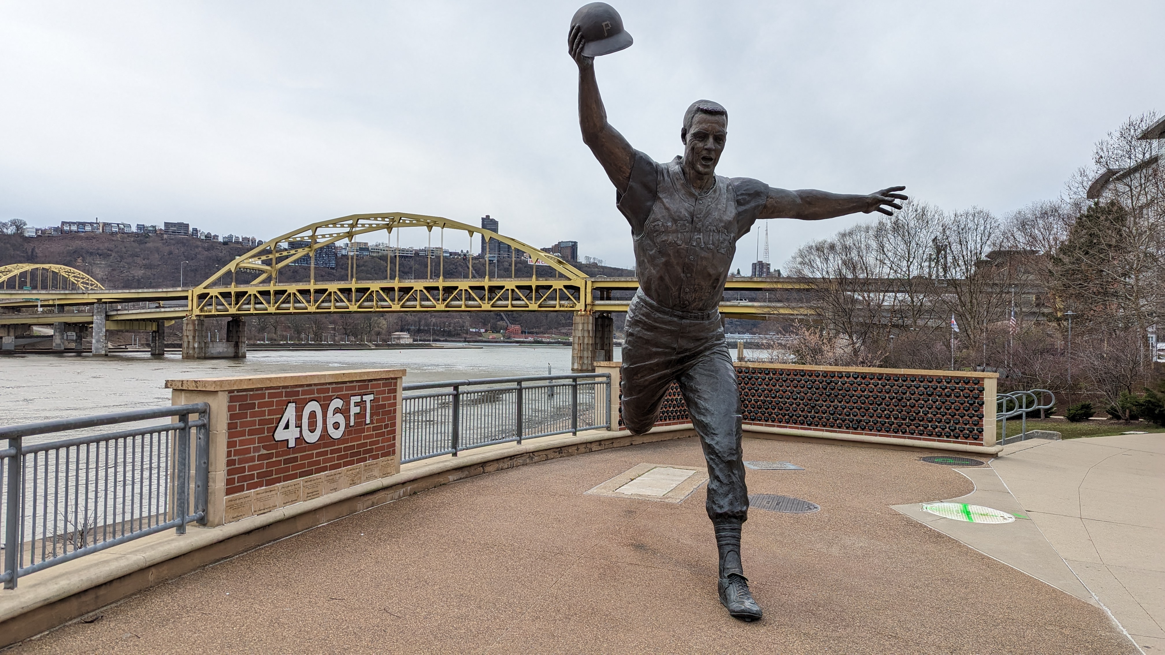
I don't know anything about sports. I assume this a monument commemorating a guy who threw his hat 406 feet. Impressive! 


This sign makes the trail look steeper than it really is. 

We still had to drive to the bed and breakfast we'd reserved for the next leg of our trip, and we planned to do a sunset ride once we reached that destination, so we didn't have time to linger. If we do this again, I'd definitely be interested in exploring more of the Three Rivers Trail, and would likely follow the GAP further down the south side of the river. That said, Pittsburg is really its own experience. The rest of the GAP has its own personality, which we'll be talking about in upcoming posts! 

Sunday, October 4, 2020

Biking the New River Trail, Virginia

 Date Biked: September 5, 2020 (plus some photos from July 3)

  • Total miles Tracked: 61.56 miles 
  • Type of Trail: Rail trail, gravel surface
  • Conveniences: Parking, picnic tables, bathrooms, two staffed visitor centers
  • Best Features: Mile after mile of rural beauty with plenty of access points and facilities. 
  • Worst Features: Very rough surface in spots, muddy in others. Also, you'll be dodging quite a bit of manure.
  • Wildlife spotted: Racoon, deer, herons, rabbits. Not wildlife, but you'll also see horses and cows.  
  • Vegetation: Mountain laurel, rhododendron, assorted hardwoods, various wildflowers
  • Associated Website:https://www.dcr.virginia.gov/state-parks/new-river-trail
  • Primary Author: James 

Virginia's longest rail trail is the New River Trail State Park. It stretches from Galax, Virginia to Pulaski, with a spur to the small town of Fries. Officially, the trail is 54 miles, but if you want to ride the whole thing in one day, you should count the spur to Fries twice, meaning you'll be biking just shy of 62 miles. 


Biking the whole distance in a single day is a challenge! The trail surface is quite variable. Starting out of Galax, the gravel is so smooth and even it almost feels like you're riding on pavement. But, there are other sections where you're just riding on parallel muddy ruts through fields, and plenty of rough and rocky sections that will put the shock absorption on your mountain bike to the test. We wouldn't recommend a road bike on most of the trail. 


That said, if you can put up with the jostling, the good news is that, if you start in Galax, you'll be riding on a mostly downhill grade for close to 40 miles. It's only after you cross the Hiwassee bridge about ten miles before you reach Pulaski that you encounter a sustained uphill grade. Cheryl and I rode up this mountain several years ago when we were still fairly new to biking and thought we'd never make it to the top, but on this trip we flew along the uphill section without any difficulty.  


All along the ride, you're reminded of the railroad history. Most of the bridges are built on old trestles, and there are two tunnels and several cuts where you ride along cliffs. There are old train stations along the way, with one just outside of Galax and another in Foster Falls that have been converted into visitor centers. 


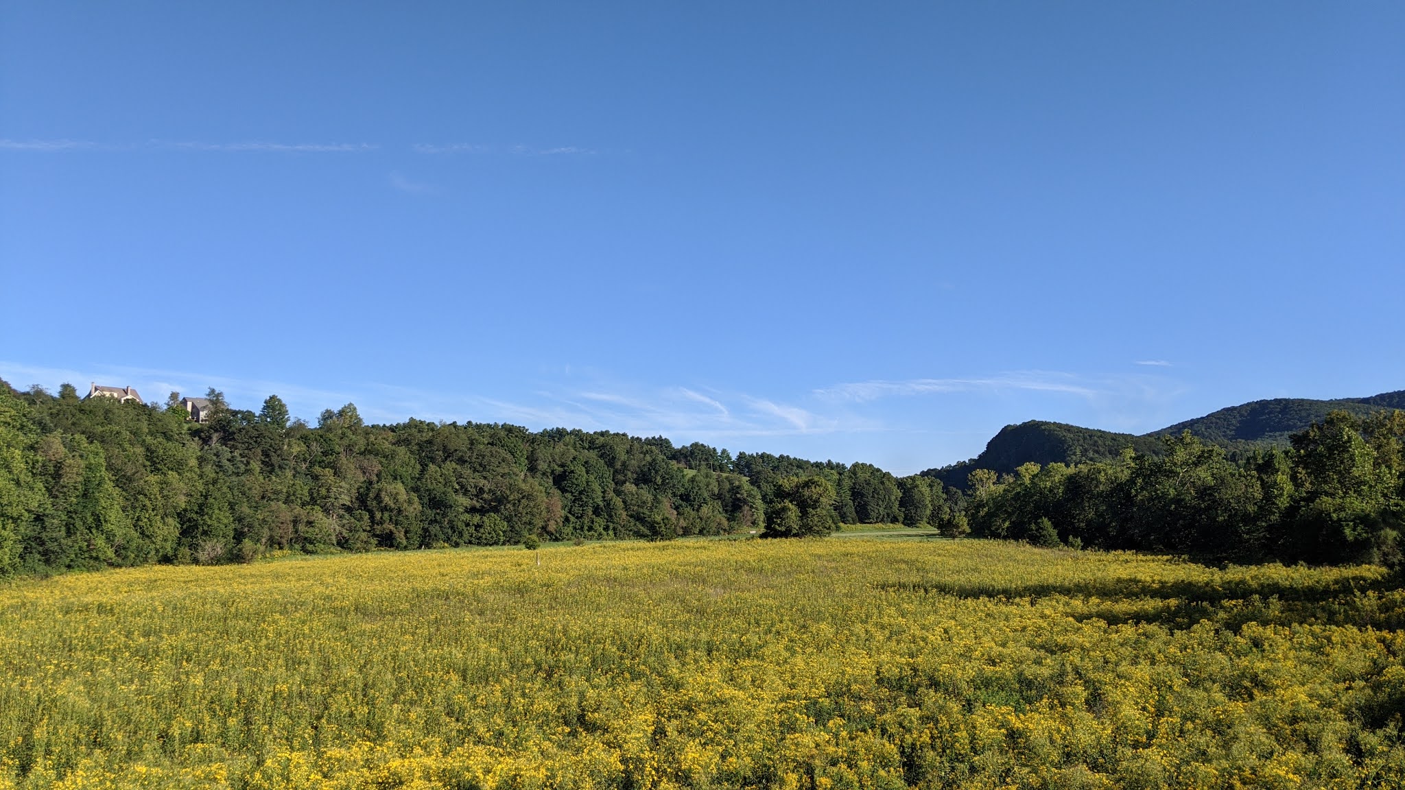
If you'd rather look at nature instead of the remains of a railroad, you're in luck! For most of the ride, you're seldom far from the New River. There are great views all along the way, and plenty of wildlife and wildflowers. Even though you're riding on a mostly flat railroad bed, mountains and cliffs rise up and fall away next to you all along the way. There are some farms, but mostly you pass through forest. Look for herons fishing in the rivers and deer grazing at the edges of open fields. We spotted a baby racoon on our ride, and there are signs all along the trail letting you know to be on the lookout for bears. So keep your eyes open! 


One animal we've encountered every time we've ridden the trail has been horses. The remote, rural flavor of the trail makes horseback riding a popular activity, especially between Foster Falls and the spur to Fries. If you're biking the trail, take extra caution with the horses. Some are ridden by novice riders which can make the horses skittish around bikes. And, of course, if there are horse on the trail, there will be poop on the trail. It makes it a little tough to look at the gorgeous scenery when you have to keep your eyes fixed on the trail to avoid unpleasant splatters. 


We definitely recommend taking the spur to Fries if you have time. First, this will give you great views of the river. Second, at the end of the trail you'll find The CafĂ©. We've eaten here a couple of times and the food and service are top notch. 


Another notable spot along the trail is Shot Tower State Park just before you reach Foster Falls. We skipped it this time since it looked like there was a crowd heading up to it, but if you have time to climb to the top of it you'll be rewarded with an amazing view of the surrounding area. 

Foster Falls is more or less the midpoint between Galax and Pulaski. In the old train station, you'll find bathrooms and a gift shop where you can grab a soda and some ice cream. Don't skimp on the calories, since you'll need for the rest of the ride. If you are riding the full length, by the time you ride past Foster Falls you'll likely be in the shade of the mountain by early afternoon. This part of the trail felt ten degrees cooler than the rest of the ride. 


Eventually you reach the Hiwassee bridge, cross the New River, and start your climb toward Pulaski. The good news is, while it's a sustained grade, the surface really smooths out. There are also multiple amazing views of Claytor Lake (which is the New River, dammed). After you pass over I81, the remainder of the ride into Pulaski is all downhill, but watch out for gullies. Finally, there's a spur trail that takes you to downtown Pulaski, but we've never ridden it. If you recommend it, let us know in the comments! 


One last note: Parking is $8 per car at most of the official trailheads. You can pay by smartphone, but given the spotty reception around some of the trailheads, it's probably easiest just to bring cash.