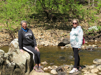
- Date Hiked: April 11, 2020
- Total miles Tracked: 5.9 miles
- Type of Trail: single track foot trails, gravel roads
- Conveniences: None.
- Best Features: The scenery!
- Worst Features: Lack of parking at gate entrances
- Wildlife spotted: Nothing this trip, but deer aren't uncommon.
- Vegetation: Pine and hardwood forests, innumerable wildflowers
- Associated Website: https://dukeforest.duke.edu/
- Primary Author: James
With most state parks and many local trails shut down, a great deal of our hiking this spring has been focused in Duke Forest. This outdoor laboratory is owned by Duke University and consists of several divisions in Durham and Orange counties. There are numerous gates leading into the various forest segments and they can be tricky to locate. You won't find the brown feature signs that normally point you toward federal, state, or local parks, and most of the trails don't show up on Google maps, though some do. Some of the trails are gravel roads okay for mountain biking, though most are fairly short and not particularly challenging. Also know that if you want to hike in Duke Forest, none have bathrooms or water, and none that I can think of have picnic tables or shelters. With few exceptions, the gates don't have parking lots, which means you're frequently having to park on the narrow shoulder next to the road, and the driver is opening their door into traffic and the passenger is stepping out into weeds.
 |
| Some of these weeds might have butterflies on them! |
As you start the hike, you'll be on the north side of the creek, and a good bit of the south side will be low cliff faces. The water on the day we walked was extremely clear. For the first mile or so of the hike you catch glimpses of houses across the creek, but soon you reach a turn that will take you far from most reminders of civilization for at least a few miles.
Most of the walk is flat, but a few miles in things start getting rocky. There's a creek you'll need to cross. There's no bridge, but it's not very deep or wide. After you pass the creek, you're heading for Piney Mountain. This is going to be the most challenging part of the hike. If you want, you can go up and over Piney Mountain, then back down to the creek. If you choose to stay at creek level, you'll be walking along some wonderful rock formations, but depending on the water level, the trail can provide some challenges. There are places where the cliff juts out and forces you to grope around blindly for footholds and handholds to edge around it. I imagine that, in dry spells, you could just rock hop out into the creek. On the other hand, if the creek had been six inches higher, I don't see how you'd make it on this trail without getting your feet wet.
 |
| You might get your feet wet even if it hasn't been raining. |
 |
| By the end of the day, we were thinking of this section as "the easy part." |
Once you're past Piney Mountain, things stay fairly rocky. It's level, but you need to watch where you're putting your feet. You'll hit a few more tight spots that require scrambling over and around large rocks, and pass by dozens of impressive cascades and rapids.
 |
| Great scenery, but you'll mainly be watching your feet. |
All in all, if you can leave a car at both gates, it's a good through hike of nearly six miles, a decent length for this area. It's rugged, but I wouldn't describe it as strenuous. A good hiking stick will help immensely. And, this is definitely a dry weather hike. Large sections of the rocky path next to the creek are plainly just part of the creek bed when the water is high, to you might want to steer clear if it's been raining. But, if the weather's good, bring your camera. There's wildflowers everywhere, and the scenery is amazing.


No comments:
Post a Comment