Wednesday, July 8, 2020

Kayak on Eno to Hickory Hills Boat Ramp, with side trip up Ellerbe Creek

  • Date Kayaked: May 23, 2020
  • Posted length: NA
  • Total miles Tracked: 9.84 miles 
  • Type of  Paddle: River/Lake (flat, low current)
  • Conveniences: 24 hour boat ramp, plenty of parking
  • Put In:  Eno River Boat Ramp near Red Mill Road, Durham, NC
  • Take out:  Hickory Hill Boat Ramp
  • Conveniences: 24 hour access, plenty of parking
  • Best Features:  Not many motor boats, great area for birds
  • Worst Features: Falls Lake can be too shallow even for kayaks during low water
  • Wildlife spotted: Osprey, herons, water snakes, other birds
  • Vegetation: Forested shores with plenty of wildflowers
  • Primary Author: James

Eno River is our hometown river, winding through downtown Hillsborough before entering a State Park that covers about fifteen miles of its shoreline along the north end of Durham. For most of this length, the water is fairly rocky and shallow. You could probably kayak some long stretches, but you'd likely be dragging your kayak over and around gravel beds most of the year. The other thing that makes it unattractive for kayaking is a lack of good launching points. 

Also, there are a lot of water snakes. We count this as a plus, but you may have a different opinion. 
However, once you get past an old railroad bridge near Old Oxford Road in Durham, the river changes in character. Miles before it reaches Falls Lake, the Falls Lake Dam causes the river to slow down, becoming deeper and broader as it leisurely winds through forests. This area has a 24 hour boat ramp not far from Red Mill Road. Some motorboats do launch from here, but most of the watercraft we encounter in this area are other kayaks. Motorboats have a much better access to the lake only ten minutes away, the Hickory Hill Boat Ramp. 


The relative nearness of the two boat ramps has tempted us for some time. It certainly seemed plausible to put in at the Eno Ramp and paddle to Hickory Hill. The only thing that made us nervous was that we'd paddled that end of the lake before and found it to be nearly impassable due to shallow waters. There's a channel you can wind through, but on a glassy smooth lake it can be tricky to find. Still, we decided to just go for it. 


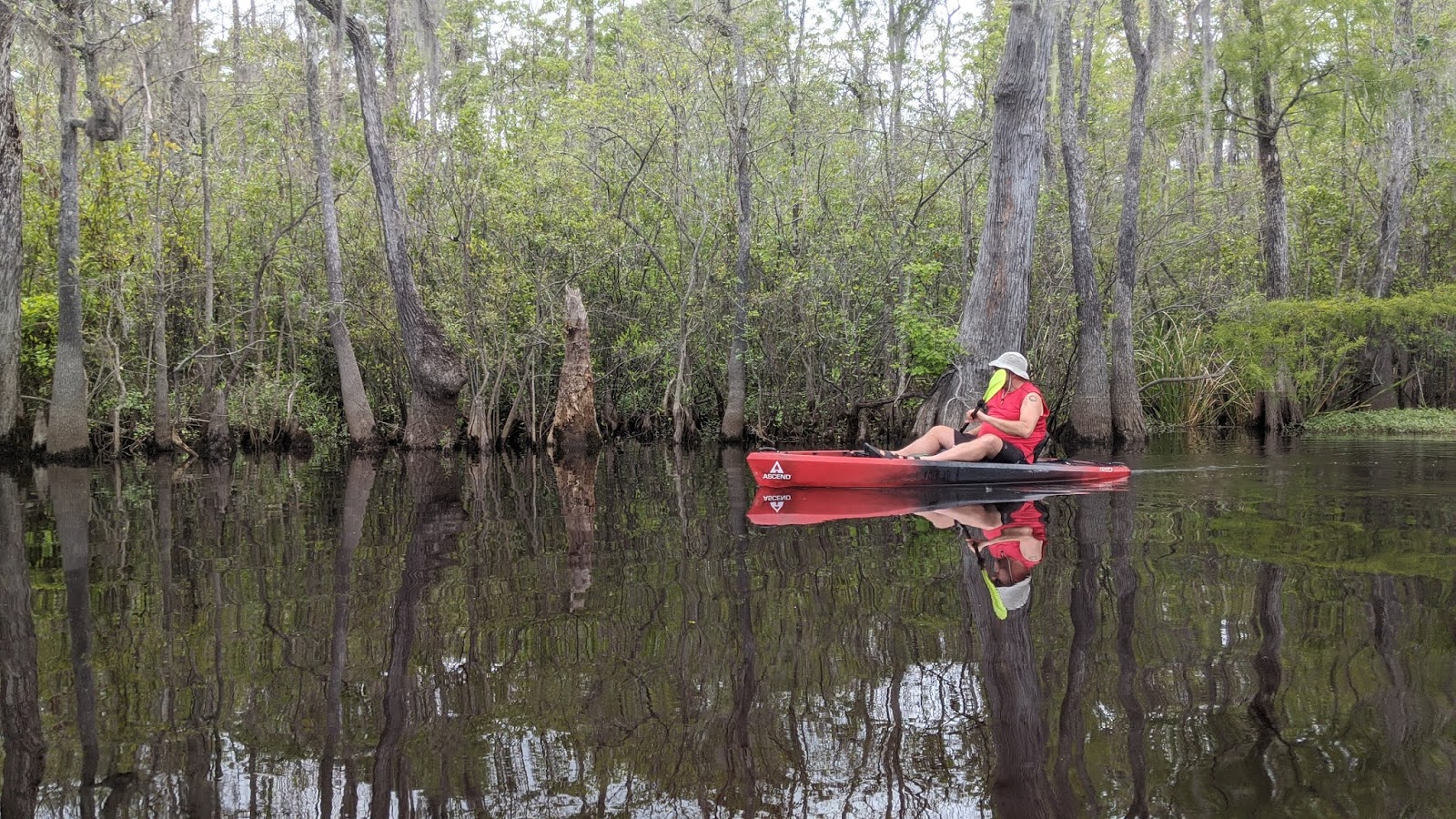
By chance, water levels weren't an issue. Spring rains had swollen the river and the lake far above their normal levels. Areas of the lake that had been dry, grassy fields were now under a yard or more of water. Small oxbow lakes normally cut off by strips of land had rejoined their waters of origin. All through the flooded forests, we could see and hear fish flopping and splashing as they swam among the bushes and branches.  

Not pictured here, the actual boat ramp, which is underwater. 

One nice thing about the water being this high is that it's easy to find shade!
Since the water was so high, we decided to take a shot at going up Ellerbe Creek. We'd visited the mouth of this creek before and found it clogged with flood debris, dead trees and a depressing amount of litter. This time, the dead trees were still blocking the primary channel, but the water was high enough to paddle around them. Once you were past the litter, the creek itself was quite pleasant, with shores abundant with wildflowers and the ruins of an old bridge that once crossed the creek slowly being reclaimed by the wilderness. We kayaked up the creek to Red Mill Road, about a mile, and the next time the water gets that high we may push further up the creek. 


Returning to the lake, we glided along its mirrored surface among numerous water birds. Because of the typical shallowness of this area, many different types of birds nest here, including ospreys and herons. The one downside of this part of the lake is that you're very close to I-85, so there's a more or less constant drone of traffic. 


Once you pass under I-85, there's only about a mile left to reach the Hickory Hill Boat Ramp. There's a sandy area next to the closest ramp that's great for taking out. We have two vehicles that can carry kayaks, so we'd left my car here. We loaded the kayaks and drove back to the Eno Ramp to retrieve Cheryl's vehicle. 

This osprey feeding the young in it's next is maybe 200 feet from the interstate. Apparently, the birds don't like boat traffic, but pay no to attention to road traffic. 
Note that our detour to Ellerbe Creek turned this into a ten mile paddle. But, if you stuck to a direct route, I suspect you could make the journey in six or seven miles. Alternatively, if you were there in equally high water levels, all the side channels and areas of the lake normally too shallow to explore would give you easily a dozen miles or more to enjoy. It's definitely a route we'll paddle again. 

Tuesday, June 30, 2020

Kayaking the Waccamaw River from J Todd Landing

  • Date Kayaked: May 18, 2020
  • Total miles Tracked: 4.68 miles 
  • Type of Trail: River
  • Best Features: Wildlife, very peaceful, calm current
  • Worst Features: No facilities at landing
  • Wildlife spotted: Osprey, woodpecker, alligators, turtles
  • Vegetation: Cypress and hardwoods, wildflowers
  • Associated Website:https://www.horrycounty.org/Departments/ParksAndRecreation/Boating (Note: This is the official site, but good luck finding a mention of this location!)
  • Primary Author:  James

Back in May, we took a long weekend to kayak in South Carolina. We launched from three different boat ramps on the Waccamaw, plus kayaked in the Marsh at Murrells Inlet. We were down on the weekend when South Carolina was loosening some of their Covid 19 restrictions. This created some stressful, crowded conditions on some of the waterways we tried out. But, our final destination before we left the state was J. Todd Landing just outside of Conway. It was like a completely different river! We kayaked almost 5 miles and saw only two motorboats. 


The landing itself is rather barebones. You drive down Jackson Bluff Road until you reach a sandy parking lot. There's no boat ramp, just a beach of firm sand, perfect for kayak launches. There are a few private residences adjacent to the ramp, but this is located in the Waccamaw National Wildlife Refuge, so for the most part you'll be leaving civilization behind once you're in the water. 


For the most part... there is a curious rusting artifact downriver from the launch. What it might have once been is a mystery to us. 

Once you're past this, however, you're entering undeveloped land along both sides of the river. You're several miles from the nearest ramp where motorboats launch, and far from any road, so it's one of the quietest places we've kayaked. The lack of noise meant that wildlife was easy to spot along the river. Turtles, osprey, woodpeckers, and alligators! We spotted five alligators during this paddle, after seeing none on our previous Waccamaw trips. 


One big advantage of launching from J Todd Landing is that you're launching next to Thorofare Island. You can go downstream on the Waccamaw, then back upstream on Thorofare Creek to have a nice loop trail. Going upsteam on the creek was no challenge. For the most part, the water on the both the river and the creek is wide and deep and still as you glide along past cypress trees. There are oxbows and side creeks to explore if you have time. 


Overall, this has shot to the top of our favorite places to paddle in South Carolina. It's got a great combination of ease of access, wildlife, paddling conditions, and a loop route that's long enough to be worth the journey, but not so long it turns into a slog. This is one of those places we almost hesitate to write about, since isolation and emptiness is part of it's charm. Hopefully we won't see you out there!


Monday, June 15, 2020

Biking the Lynchburg VA Trail system

  • Date Biked: May 2, 2020
  • Total miles Tracked: 19.85 miles 
  • Type of Trail: Greenway
  • Best Features: Long trail road tunnels and bridges
  • Worst Features: Creekside trail is very rugged
  • Wildlife spotted: None
  • Vegetation: Pines and hardwoods, wildflowers
  • Associated Website:https://www.lynchburgparksandrec.com/trails/
  • Primary Author:  James

They Lynchburg greenway and rail trail system doesn't pop up if you're googling for long greenways, which is a shame, and something of a branding problem. Lynchburg's trail system is mostly interconnected and cumulatively adds up to permit 20 miles + of biking without ever once needing to ride on a road. But, rather than advertise it as one big trail, it gets promoted as a bunch of little trails: The Riverwalk Trail, the Blackwater Creek Trail, the Kemper Station Trail, and the Point of Honor Trail. There's also several unpaved mountain bike trails connecting to this, including the Creekside Trail, which has a very rough and rocky access but then flattens out into a fairly nice ride. If you're like us, you might not be motivated to load up your bikes and drive two hours to ride the three mile long Blackwater Creek Trail, or even the 6.5 mile Riverwalk. Once you discover that these are really one long greenway, the destination becomes more tempting. 


You should give in to that temptation! First, downtown Lynchburg is near the hub of three of the trails, and it's a wonderful, walkable historic area, with plenty of restaurants catering to people who've come downtown for recreation. It's a very nice blend of the old and the new, and Lynchburg gets high marks as a town that seems to really appreciate the users of its greenways. 


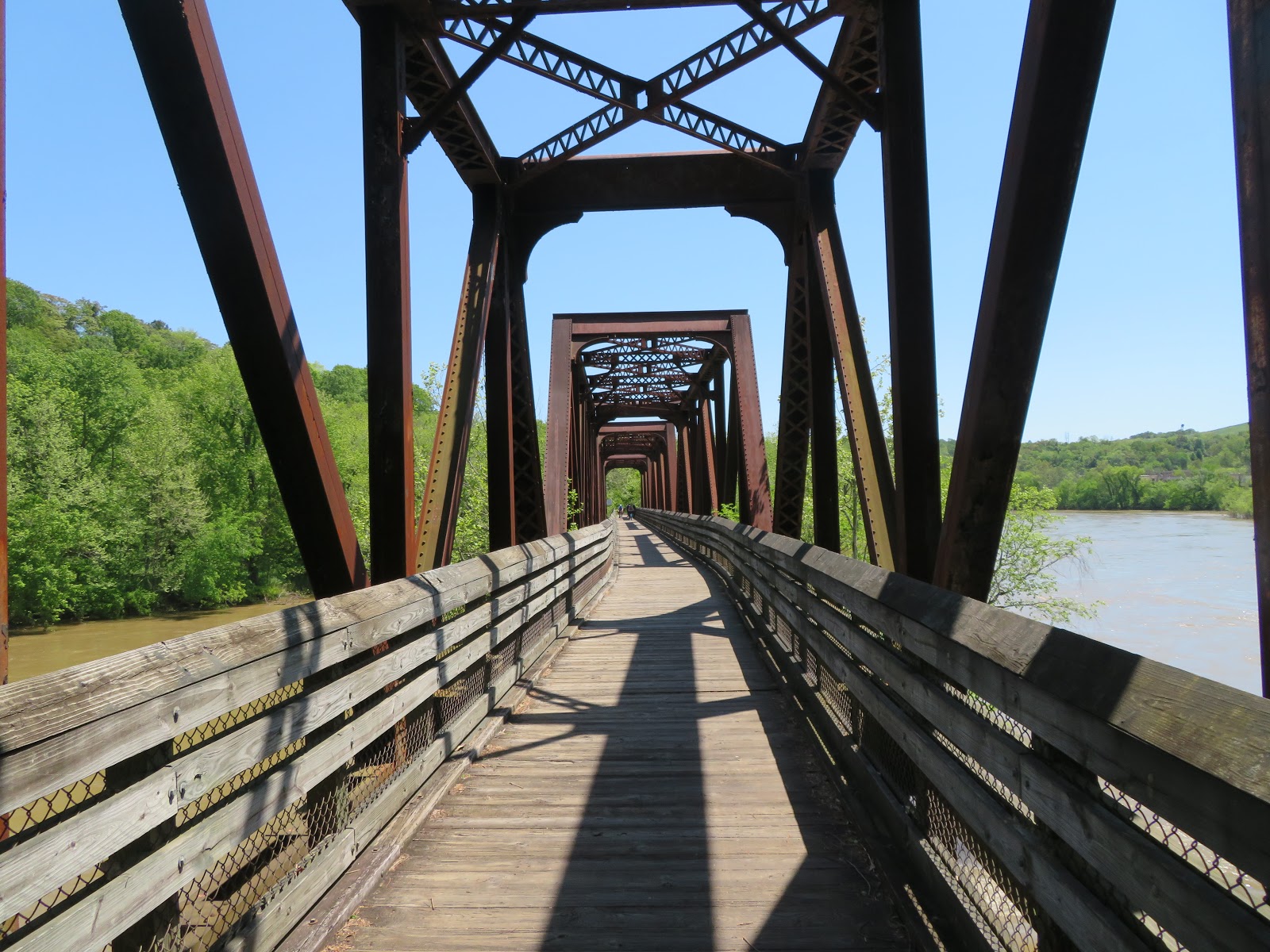
Another nice feature of the rail trail segments of the trail system is that Lynchburg is still very much an active railroad hub. You'll almost definitely encounter trains if you're in the area for any length of time at all. And, the rail trail makes use of some fantastic relics from it's previous life, including the Hollins Mill Tunnel on the Blackwater trail and a big trestle bridge on the Riverwalk at the end of Percival's Island.  


There are numerous trail access points, but the best two we've found are the Awareness Garden at mile 0 of the Blackwater Creek Trail, which has bathrooms and a water fountain, and the downtown parking for Percival's Island, which you'll recognize by Lynchburg's "LOVE" sign. No bathrooms or water here, alas, but it does give you easy access to the part of the trail that runs downtown. 


The trails do have a few challenges. The Kemper Station Trail is short, but a real work out, pretty much a continuous uphill grade, though it is fun to zip back down. We didn't ride the full length of the Creekside Trail because it was very muddy, probably because, you know, it's beside a creek, and it was spring time, and there was evidence that parts of this trail are probably underwater for parts of the year. Speaking of being underwater, the Point of Honor Trail crosses a spillway just beneath a dam. We wound up walking our bikes across because the water looked pretty swift, though in retrospect riding through it wouldn't have been any particular challenge. Even if you don't get wet here, prepare to be dripped on in the Hollins Mill Tunnel, which was pretty wet the day we visited. I imagine as we move deeper into summer the trail system will be dryer,


One final recommendation of the trail system is that it's got a nice variety to it. On Percival Island, the trail is flat and straight and rolling through forest and fields, while the Blackwater segment is full of deep railroad cuts, the tunnel, and is generally steeper. I'm hard pressed to think of another trail that packs in such a wealth of different scenes into so few miles. 


The LOVE sign on the Riverwalk features bike wheels, boot prints, kayak paddles and skate wheels. It pretty well sums up our feelings about this trail. It's just a lovely place to spend a day engaging in one or more these activities.